Showing posts with label NOTAMs. Show all posts

Wednesday, September 28, 2011

Go For the Burn(out)

A very busy summer has left me with blogger fatigue and general irritability. I changed my blog template. Didn't help. So I'm going to whinge on for a bit, but I'm including some pretty pictures at the end. You may just want to skip ahead ...

And That's Not All!

AOPA is really annoying me, whining about how the FAA should provide tail-number blocking for wealthy aircraft owners. Business jets make sense for business (Duh! Hence the name!). If business aircraft are so profitable then they don't need tax breaks and accelerated depreciation schedules to make them make business sense. Right?

AOPA keeps sending me solicitations for life insurance, renter's insurance, and the latest - the opportunity to purchase a subscription to their DVD series. Oh, and you can return the DVD or just recycle it. Who do they think they are, National Geographic?

The editorial tone of AOPA Pilot sure has changed. First there is the faux controversy of their Dogfight series where two diametrically opposed writers (or so we're led to believe) disagree with each other about whether pitch controls airspeed or altitude. Yawn! Or a photo spread about aviation tattoos. Very hip and edgey! What's next, aviation piercings?

AOPA members shouldn't be surprised at the changes that have taken place. Just enter the AOPA president's name into a Google search and see what he was doing back in the early 1990's.

See what I mean? Irritable ...

Amazon to the Rescue!

Amazon has cancelled their associates program for residents of California. Why? Because California legislators and the governor passed legislation that requires them to collect sales tax. Being the magnanimous folks they are, the management at Amazon pulled the plug. Okay, fine. Then they turn around and start lobbying California legislators for sales tax amnesty. Hello? Amazon? Did you not read the news about the State's budget hovering around the edge of the porcelain pony? We're trying to have a civilization here!

So I'm no longer an Amazon Associate. I'm all busted up about that ...

No Taxes, No User Fees


I'll be the first to admit that user fees for GA will hurt. I'd hate to see them implemented. On the other hand, a lot of people seem to be in a budget-slashing, anti-government mood. To quote a line from The Right Stuff - "No bucks, no Buck Rogers." The aviation gasoline tax is  apparently not bringing in enough moolah, so something has to give.

Many pilots have multiple personalities when it comes to taxes and government. No one wants to pay, no one want to be regulated, but everyone is upset when local airports can't make ends meet. Do they think runways, taxiways, control towers, ATC salaries and FBO facilities simply appear out of thin air? Where will the funds for the much vaunted NextGen come from? Maybe AOPA can donate proceeds from one of the marketing promotions ...

NOTAM Madness

There are a bunch of NOTAMs for my local airport due to a bunch of construction projects and the cranes and equipments associated with same. While trying to explain the NOTAM system to a student pilot recently, he had an epiphany: "The trick to NOTAMs is knowing which ones to ignore." Leave it to a neophyte to come up with the good insights.

The NOTAM system has been changed so that it is supposedly easier to wade through, but the almost indecipherable content of each NOTAM remains maddeningly the same. Dates and times in the most foreign format imaginable. Contractions and abbreviations that make normal human beings cringe. And mind-numbing legal boilerplate makes it seem like the FAA and TSA actually want someone to bust a TFR.

Comment Etiquette

I've been getting more and more comments that are lame attempts at using my blog for third-party marketing. The comments are usually complimentary, but they contain a link to some site that often has little to do with the post I've written. How very crafty and clever! Folks who post these things need to know that they aren't fooling anyone and their lame links will never see the light of day on this blog.

Some commenters post things when they really want to send me a message. Please, use my email address. It's shown on the right edge of my blog. If you're using a blog reader, you may need to actually visit my blog directly to see it. Please don't comment if you're trying to send me a personal message. Use email, 'K?

If you don't agree with something I written and you want to post a comment, by all means do so. Keep in mind that I have the final say in which comments are published. Comments that I find rude, inflammatory or otherwise piss me off will go to /dev/null. If you don't understand irony, this might not be the place for you and you are hereby advised to avoid reading my blog. If you don't like my ideas, that's fine, too. Don't waste your time with verbal jousting, move on to another blog you like. Or send a letter to the AOPA editors and tell them how much you like arguments about engine leaning and racy photos of tattoos.

At least I'm not irritated when I'm flying.

Now the pretty pictures I promised ...


Alameda Sunset

Another Bay Area Sunset

FAF VOR 6 at KAPC

Odd Valley Stratus for Summertime

Delta Farmland

Slipping the Surly Bonds

More Odd Stratus

Right turn 090, Join V244, Resume Own Nav ...

Montezuma Windmills

More Windmills

Tiny Full Moon (see it?)

Northwest of KNUQ

Sonoma Valley Sunset

Northeast of Eden

Vectors across the Bay

VFR, Kinda, Sorta ...

Contact Norcal Departure ...

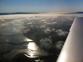
Salt Ponds and Stratus

Again with the Salt Ponds?

San Pablo Bay at Sunset

Guess Where?

Short final, KHAF RNAV RWY 12

Again with the marine layer?

Surreal Delta Light

Alameda Estuary at Sunset

Tuesday, May 31, 2011

Can LightSquared 4G and GPS Coexist?

There's a common line of thinking among some folks in the aviation community that the federal government doesn't restrict cellphone use in an airborne aircraft, that cellular telephones do not interfere with radio navigation, and that it's fine to use a cellphone or have it powered on in flight. The usual reasoning I hear from pilots who leave their cellphones on or use them in flight is that since they've never seen any problems, no such problems exist. The fact is that we are surrounded by an ever-growing sea of radio frequencies and detecting interference requires a more rigorous approach than casual observations made by individuals. If you need more convincing that radio frequency (RF) interference can be serious, look no further than the proposed LightSquared 4G broadband network and the impact it may have on GPS users.

Never Seen a Leprechaun

It's understandable how some pilot's come to the conclusion that cellphone use is okay in an airborne aircraft since the relevant aviation regulation, 14 CFR 91.21, appears to permit cellphone use if the operator or pilot-in-command has determined there's no interference or if the flight is conducted under visual flight rules. The regulation provides no guidance on how one is to test for interference and that could lead one to conclude that the FAA doesn't care if you use your cellphone in flight. Consult the portion of the Code of Federal Regulations that deals with the FCC to find the regulation, 47 CFR 22.925, that clearly and specifically forbids the use of cellular telephones in flight. The FAA may not care, but the FCC clearly does care.

The common follow-up argument is that the FCC ban is out-of-date and that there's absolutely no problem with leaving your cellphone on or using it in flight. Folks who make this assertion usually do so based on their personal experience in their own aircraft. An important element in this line of thinking is a strong desire to do what is convenient, not so much on any rigorous measurements of radio frequency (RF) interference. While I haven't made any specific measurements with sophisticated equipment, I have noticed several basic types of cellphone interference in aircraft.

In one aircraft I occasionally fly, one of the two VOR receivers will show a 15 degree error at a ground VOR checkpoint whenever an iPhone 4 is turned on and placed in the console directly below the radio stack. Put the iPhone 4 in airplane mode and the VOR error goes away.

I've also demonstrated interference between cellphones and my portable Zaon PCAS MRX traffic detector that manifests as false traffic alerts. It took me a while to correlate this, but on several occasions the Zaon MRX gave continuous traffic alerts for an aircraft within a mile and at the same altitude. Asking ATC if they saw any traffic in my area always resulted in the same response: "Negative." On one such occasion, we heard the unmistakable sound of cellphone data transmissions over the intercom (dit-da-dit-dit-dit-dit-dit ...). When we located the offending cellphone and put it into airplane mode, the intercom interference went away and so did the phantom aircraft that the Zaon MRX had said was within 0.3 miles and at the same altitude.

Just because you've never seen a leprechaun, that doesn't mean they don't exist.

4G vs GPS

While I've never been able to correlate cellphone interference with GPS receivers, at least one next generation 4G network system appears to pose a widespread threat to GPS accuracy. The FAA has been issuing NOTAMs over the past several months warning of potential GPS unreliability related to the testing of new 4G network equipment created by LightSquared.

In January of this year, the FCC issued a waiver to LightSquared allowing them to move forward with plans to deploy transmitters that uses the L band 1 spectrum to provide a high-power terrestrial broadband service. While this could be great news for people in remote areas that want high-speed data transfer on their mobile device, GPS experts and users are concerned. The 1525 MHz-1559 Mhz band is very close to the 1575.42 Mhz band used by GPS.

Recent tests of LightSquared's 4G equipment has inconvenienced many users of GPS. On one occasion, I was unable to get a clearance to fly an RNAV approach because the NOTAM prevented ATC from allowing such approaches during the testing. Imagine aerial survey companies who rely on WAAS GPS to do their mapping or ships that rely on GPS for maritime navigation. Aside from acquiring the necessary equipment and databases, GPS is provided without charge. The LightSquared 4G product will undoubtedly be a commercial product and user's will understandably have to pay for data access. Whether it's the profit motive or a large number of lobbyists, the implementation of LightSquared's network is continuing at a rapid rate.

Hope you like Jammin' Too

Testing done by Garmin showed that an automotive nuvi 265W GPS receiver was jammed when within a 3 to 4 mile distance of a LightSquared transmitter. Garmin's aviation GPS receiver tests were even more sobering with jamming of a 430W occurring within 9 to 13 miles of a LightSquared transmitter and a total loss of position occurring within 5.6 miles.

The waiver granted to LightSquared by the FCC requires that a working group identify and reconcile conflicts between 4G and GPS, but the onus appears to be on the GPS community, not LightSquared:

Because the GPS interference concerns stem from LightSquared’s transmissions in its authorized spectrum rather than transmissions in the GPS band, the Commission expects full participation by the GPS industry in the working group and expects the GPS industry to work expeditiously and in good faith with LightSquared to ameliorate the interference concerns.


The FAA has gone to considerable lengths over the past several years to create RNAV approaches with vertical guidance and to expand the WAAS service volume. With the number of LPV approaches outnumbering the number of ILS approaches, the potential conflict between GPS users and companies that want to provide satellite-based broadband is very, very serious. For my money, it's more important to have accurate RNAV than to be able to update my Facebook page while hiking the John Muir Trail.

LightSquared reportedly wants to install up to 40,000 high-power transmitters operating at up to 15,000 watts (42 dB). So the latest threat to the integrity of GPS isn't solar flares or aging satellites, it's wireless broadband. Until this gets resolved, be sure to check those NOTAMs. And if you haven't practiced navigating with VORs lately, you might want to dust off those skills.

Monday, October 11, 2010

How Many Engineers Does it Take?

OAK 09/200 OAK NAV VORTAC OTS TIL 1010312359

The Oakland VORTAC has been out of service for, well ... I think it was NOTAMed back in April or May of 2010. Pretty amazing when you consider this is one of the major navigation aids on the West Coast: It defines six Victor airways, six Jet airways, and numerous airports have instrument approaches, departure procedures, and arrivals that rely on it. So what is the FAA doing to the Oakland VORTAC and why is it taking so long? This isn't the entire story, just some of the pieces.

The Oakland VORTAC was missing in action for an extended period about six years ago when a range of radials had become unusable and an effort was undertaken to figure out why. Around that time the Ron Cowan Parkway had just been completed, named after the developer of the nearby Harbor Bay business and residential developments.

Sometimes called the road to nowhere, the project to build the Cowan Parkway figured in an FBI probe that started after allegations of impropriety between Mr. Cowan and then state senator Don Perata. It seems that some folk thought the road was primarily designed to increase the value of Mr. Cowan's real estate holdings at Harbor Bay at taxpayer expense, but that's a deep topic. So moving on I'll point out that the Cowan Parkway divides the Oakland Airport in half, provides alternate access to the FedEx ramp and the South Field terminal as well as an alternate route for residents of Bay Farm Island. Cyclists also benefit from bike lanes that flank the road.

Building the parkway was a big project, in part because a tunnel had to be constructed under Taxiway Bravo, the only connection for taxiing aircraft between Oakland's South Field and the North Field. In addition, airport perimeter barriers had to be adapted and new chain link fencing and razor wire installed. After investigating, it was determined that the new fences were close enough to the VORTAC that they were distorting the signals. Sections of the fencing were replaced with redwood (which you can see in the photo above), the FAA's flight check aircraft conducted various tests, there were still some radials in the Northwest quadrant deemed unusable, but the VORTAC was returned to service and life got back to normal, mostly.


Recently an initiative was undertaken to dopplerize the Oakland VORTAC to increase its accuracy and eliminate or reduce the number of unusable radials. This is the project that started in earnest last spring and after a month or so, a bunch of little mushroom-shaped antennae were seen ringing the main bowling pin antenna.

In July the flight check aircraft was testing the results. I remember one of the days because the FAA's flight check King Air made quite a stir, flying the OAK VOR RWY 9R approach when all other traffic was landing runways 29, 27 Left and 27 Right. A student I was flying with had to break off a practice approach, but I didn't mind because I assumed this meant progress was being made. Yet as the end of July approached, the NOTAM was changed to show the VORTAC returning to service at the end of September. Then I got wind of some of what was going on.

It seems that the new configuration failed the high-altitude flight check and a new effort was underway to determine why. At one point a theory was that surplus concrete debris that the airport facilities folks use to repair the numerous dikes and levees around the airport was causing the problem. The concrete chunks were piled up near the VORTAC, some of the chunks contained rebar, and the thought was this was distorting the VORTAC's signals. This isn't the first time rebar has affected aviation at Oakland: A few years ago it was discovered that both compass roses had been constructed with concrete that contained rebar, which could explain why so many compasses that were swung at Oakland seemed screwed up. The compass roses remain closed.

USD 05/081 NUQ AIRSPACE SOUTHLAND ONE DEPARTURE... NA EXCEPT FOR AIRCRAFT EQUIPPED WITH SUITABLE RNAV SYSTEM WITH GPS. OAK VORTAC OTS.

USD 05/083 LVK AIRSPACE LIVERMORE ONE DEPARTURE... PROCEDURE NA EXCEPT FOR AIRCRAFT EQUIPPED WITH SUITABLE RNAV SYSTEM WITH GPS. OAK VORTAC OTS.

USD 05/085 SFO AIRSPACE PORTE THREE DEPARTURE TAKE-OFF RUNWAYS 10L/R AND 19L/R: PROCEDURE NA EXCEPT FOR AIRCRAFT EQUIPPED WITH SUITABLE RNAV SYSTEM WITH GPS. OAK VOR OTS. 

USD 05/097 SFO AIRSPACE SHORELINE ONE DEPARTURE...
PROCEDURE NA EXCEPT FOR AIRCRAFT EQUIPPED WITH SUITABLE RNAV SYSTEM WITH GPS. OAK VORTAC OTS. 

USD 05/082 OAK AIRSPACE SKYLINE THREE DEPARTURE...
RWYS 9L, 9R, 11 NA EXCEPT FOR AIRCRAFT EQUIPPED WITH SUITABLE RNAV SYSTEM WITH GPS. OAK VORTAC OTS.

USD 05/084 OAK AIRSPACE MARINA FOUR DEPARTURE...
NA EXCEPT FOR AIRCRAFT EQUIPPED WITH SUITABLE RNAV
SYSTEM WITH GPS. OAK VORTAC OTS. 

USD 05/149 OAK AIRSPACE SALAD ONE DEPARTURE NA EXCEPT FOR AIRCRAFT EQUIPPED WITH SUITABLE RNAV SYSTEM WITH GPS. OAK VORTAC OTS.

USD 05/087 CCR AIRSPACE BUCHANAN NINE DEPARTURE PITTS TRANSITIONS: NA EXCEPT FOR AIRCRAFT EQUIPPED WITH SUITABLE RNAV SYSTEM WITH GPS. OAK VORTAC OTS.

USD 05/086 APC AIRSPACE LIZRD THREE DEPARTURE OAKLAND TRANSITIONS: NA EXCEPT FOR AIRCRAFT EQUIPPED WITH SUITABLE RNAV SYSTEM WITH GPS. OAK VORTAC OTS.

Another repercussion has been that a local freight carrier cannot use the SALAD ONE departure because many (or all?) of their aircraft are not RNAV equipped. So instead of departing runway 27L or 27R, turning East over the San Leandro Bay, and intercepting the 060˚ radial, they have to fly heading 310 until high enough to be vectored to the East. The 310 heading takes them right over residential areas of Alameda late at night and in the early morning hours.

Pilots who wish to fly the HWD LOC/DME RWY 28L approach are required to be flying aircraft equipped with a suitable RNAV system because the missed approach holding fix is (wait for it) ... the Oakland VORTAC. I got bitten by this one a couple of weeks ago when the weather into Hayward didn't clear as forecast. My student had to fly the ILS into Oakland, then we sat and waited for VFR weather so we could reposition back to nearby Hayward. Live and learn.

VORTAC with new Counterpoise
I don't know if the theory about rebar in scrap concrete interfering with the VORTAC was itself scrapped, but the latest development was an assessment that the counterpoise (the roof of the VORTAC building) was too small. An effort was undertaken to enlarge the roof, increasing its diameter by some 16 feet to a total diameter of 84 feet. It looks like this part of the project is mostly completed and the latest NOTAM claims the OAK VORTAC should be back in service by the end of October, 2010.

In 2002, the man for whom the road was named defaulted on over $43 million in loans from Lehman Brothers and the investment bank and its property management company seized much of what Cowan owned at Harbor Bay Business Park. The road itself is not heavily travelled, though it did end up reportedly costing taxpayers over $100 million. The road appears indirectly responsible for trouble faced by pilots and a noise-sensitive community. The weather is bound to get worse as winter approaches and fixing the Oakland VORTAC could go down to the wire. We'll just have to wait and see if the FAA can pull a rabbit out of their hat or if the Cowan Parkway will continue to be the gift that keeps giving.

Thursday, January 21, 2010

Nothin' Special

I've never been a big fan of special VFR (or SVFR), a procedure that, simply put, allows pilots to operate without an instrument flight rules clearance in controlled airspace when the cloud ceiling and/or visibility are below basic visual flight rules minima. There are several reasons to be skeptical of special VFR and when the weather is poor, asking for this sort of clearance should not be the first solution you jump to, especially when other options might be available.

Attempting to fly VFR into deteriorating weather conditions and controlled flight into terrain continue to be two of the more popular ways to get into trouble in a small aircraft and these are exactly the kinds of risks that may be associated with SVFR. Besides these additional risks, pilots need to understand the regulations governing the use of special VFR, know when they can request and get a SVFR clearance, and then carefully and thoughtfully consider whether or not it might be appropriate to request such a clearance.

By the way, I'm not going to discuss SVFR requirements for helicopters since I'm not a qualified helicopter instructor. I will discuss some recent developments regarding SVFR at the airport I mostly call home, Oakland.

Location, Location, Location

Many pilots mistakenly think that if they are in controlled airspace, they can ask for SVFR. 14 CFR 91.157 describes the requirements and restrictions for SVFR. If you don't get anything else from reading this post, understand that a prerequisite for a SVFR clearance is that you must be below 10,000 feet MSL and within:
... airspace contained by the upward extension of the lateral boundaries of the controlled airspace designated to the surface for an airport.
If you're outside the upward extension of the lateral boundaries of an airport's surface airspace, you best have 3 miles of visibility and be 500 feet below, 1000 feet above, and 2000 feet laterally from the clouds. Another option during the day is to be in uncontrolled airspace with at least 1 mile visibility and clear of clouds, also known as some scary $#[+.

SVFR is not authorized in any of the Class Bravo surface airspace listed in 14 CFR 91 Appendix d, Section 3. In some cases, a Letter of Agreement may allow certain exceptions.

If you are transiting a Class B, C, D, or E airspace surface area to an airport that is reporting VFR conditions, you may still be granted a SVFR clearance if you tell the controller you cannot maintain regular VFR while transitioning. Think about this for a moment: If you are asking for a SVFR clearance to transition in Class B (assuming it's allowed), you must have less than 3 miles of visibility since you're normally only required to remain clear clouds in Class B under VFR. In classes C through E, you'd request a SVFR clearance to transition when you were unable to remain 1000 feet above, 500 feet below, and 2000 feet horizontally from the clouds and/or you expect to encounter less than 3 miles visibility.

Don't hang all your hopes on a SVFR clearance: Just because you think you're entitled to a SVFR clearance doesn't guarantee that a controller will give you such a clearance when you ask for it. Especially at Oakland. More on that later.

Pilot Requirements

Student pilots cannot request SVFR operations since 14 CFR 61.89(a)(6) clearly states they must have at least 3 miles visibility during the day. At night 5 miles visibility is required, assuming their instructor has given them an endorsement for night solo flights.

Any other pilot who yearns to operate SVFR can request it, but if the request occurs during the period between sunset and sunrise then the pilot must be instrument-rated and their aircraft must be equipped for IFR. In Alaska, these additional requirements apply when the sun is 6˚or more below the horizon.

SVFR Procedures
The minimum visibility for SVFR is 1 statute, reported at the departure or destination airport. If there is no weather reporting at the departure or destination airport, the pilot must report at least 1 statute mile of flight visibility to the controller. If the reported visibility by you or at the airport is less than a mile, the controller will deny the request from pilots of fixed-wing aircraft.

Adding to the arcane nature of SVFR, a controller cannot initiate a SVFR clearance: Pilots must specifically request it. A controller's official phraseology should sound something like:
Cessna 123, Moose Lips airport is reporting below basic VFR minimums, say intentions.
Sometimes a controller will be more informal, saying something like:
Mooney 345, Moose Lips Tower, the field is IFR, unable VFR departure, is there something special you wanted to request?
When a pilot wants a SVFR clearance, the request might sound something like:
Moose Lips Ground, Cessna 123, transient parking, VFR Redding, request special VFR departure, information xray.

Say Altitude

When a controller gives you a SVFR clearance, they don't specify an altitude to maintain since it's assumed that you, the pilot, must choose an altitude to remain clear of clouds. So the controller will say something like:
Bonanza 567, maintain special VFR conditions while in the surface portion of the Moose Lips airport class Delta airspace, runway 12, cleared for takeoff.
Or:
Cirrus 789, maintain special VFR conditions while inside the Moose Lips class Delta surface area, make a right base entry runway 30, report turning final.

Is it Safe?

Let's say you want to depart an airport where the visibility is being reported as 10 miles, but the ceiling is being reported as 900 feet. You see a hole in the clouds about 5 miles East of the airport. You reason that if you can get a SVFR clearance, you can depart, fly toward that hole in the clouds, and climb through the hole to VFR conditions. This is where you need to think carefully about your plan.

If you ask for and get a SVFR clearance, you'll end up being just under 900 feet above the ground. If your departure path is over a populated area, you won't be in compliance with 14 CFR 91.119, which says you must be 1000 feet above the highest obstacle within 2000 feet horizontally of your course. In addition, you must maintain an altitude that will permit you to make an emergency landing without undue hazard to persons or property on the ground should your engine fail.

I've seen many pilots do just these sorts of SVFR departures and arrivals. Controllers, for their part, seem to condone it. If nothing bad happens, well ... But if something does go wrong, the pilot will probably be called on the carpet for violating the minimum safe altitude rules as well as 14 CFR 91.13 - Careless and reckless operation - endangering the life and property of others. Assuming they survive, that is.

Separate and Unequal

Order 7110.65S - Air Traffic Control, the air traffic controller's "handbook," has some interesting things to say about priority of SVFR operations as well as separation of SVFR aircraft. The priority of SVFR is summed up simply:
SVFR flights may be approved only if arriving and departing IFR aircraft are not delayed.
Then later, there's this escape clause:
The priority afforded IFR aircraft over SVFR aircraft is not intended to be so rigidly applied that inefficient use of airspace results. The controller has the prerogative of permitting completion of a SVFR operation already in progress when an IFR aircraft becomes a factor if better overall efficiency will result.
Regarding separation, ATC is required to separate SVFR aircraft from each other and SVFR aircraft from IFR aircraft. The order goes on to reference separation standards from chapters 6 and 7 of that same document.

No SVFR at OAK

A few weeks ago, I was returning to Oakland at night with a student pilot in deteriorating weather. We discussed the visibility and concluded we had better than 3 miles of visibility and that we were approximately 500 feet below an overcast to broker cloud layer. After contacting NORCAL, my student was given the usual instructions for a straight-in VFR approach. A few minutes later, we were advised that Oakland was reporting below basic VFR minima and to "say intentions." Being only 7 miles from the airport, with good visibility, but in deteriorating weather conditions, I asked for special VFR. This seemed to be 1) a great teaching opportunity for my student and 2) the safest way for us to get on the ground quickly before the weather deteriorated further.

The controller approved the request, but less than a minute later instructed us to remain clear of the surface class C airspace. Oakland Tower was not allowing SVFR. Once again we were asked to say intentions, so I asked for an IFR clearance. We were given a Northeast heading, told to maintain VFR and to expect a delay for the clearance. This provided another excellent teaching situation: How things can go bad when you don't have a Plan B.

The weather began to deteriorate further, so I offered to maintain our own terrain and obstruction clearance if the controller could provide an IFR clearance immediately. The controller agreed, we turned East and then South as we climbed two thousand feet. We joined the localizer, descended, and lo and behold we were back in almost the same position we were just a few minutes earlier. "What the heck was that all about?" I wondered at the time.

A few weeks later, I was departing Oakland with another pilot to fly VFR to an airport in the Sierra Mountains for a mountain check out. It was one of those weird days where Oakland's South Field (runway 29) was reporting low visibility and ceilings while the North Field (runways 27 and 33) were scattered clouds and great visibility. The official story was that Oakland was IFR, so we called ground and asked for a SVFR departure. To our surprise, we were told that SVFR was no longer allowed at Oakland. What?

Choosing the path of least resistance, we called clearance delivery, explained we weren't pre-filed, and asked for an IFR clearance to VFR. A few minutes later, we had our IFR clearance and departed. As soon as we were handed off to approach (at about 1000'), we cancelled IFR. We actually could have cancelled IFR as soon as our wheels left the runway since we were already in VFR conditions.

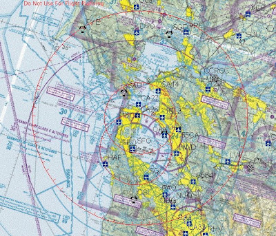
I have yet to hear the official story, but gather that someone at the FAA decided to interpret the regulations to mean that no aircraft can be given SVFR in Oakland's Class C surface area when there is any IFR aircraft arriving or departing, regardless of how much separation is between those aircraft. And there's been no warning, no indication on the San Francisco VFR Terminal Area Chart, not even a NOTAM to inform the unsuspecting pilot who has studied all the above regulations and is religiously completing their preflight planning.

I guess this is just another reason to be extremely careful when your plans seem to depend on SVFR.


Monday, October 26, 2009

ForeFlight Mobile


Several readers suggested I review the iPhone app ForeFlight Mobile and recently folks at ForeFlight contacted me. Again, in the interest of transparency, I'll say up front that I was provided with complimentary versions of their iPhone apps: ForeFlight Mobile, ForeFlight Charts, Checklist Pro, and ForeFlight File. In general, I like what I see: Stable software with excellent user interfaces suggest thoughtful design and implementation along with thorough quality assurance. I mainly cover ForeFlight Mobile in this post and plan to review the others in a future post.

ForeFlight before Flight
As its name implies, ForeFlight Mobile is primarily a preflight planning tool and I wish I'd had it few years ago. Lockheed-Martin had just taken over FSS, I was still flying freight, and I would have given my eyeteeth for a product like ForeFlight. On more than one occasion I found myself delayed on the ramp for over an hour before departing into rapidly deteriorating weather. With no internet access, I had no way to get an updated weather briefing other than call FSS on my cell phone. So I sat inside the plane, watched the pouring rain, the poor rampers getting drenched to the bone, and waited on hold for a FSS briefer. After over 15 minutes, I had to hang up. The ramp agent was pushing release paperwork at me and explaining a 727 was inbound and needed to park right where I was sitting. So I called a fellow pilot who was sitting standby and asked him to use his laptop to give me a picture of the weather. If I'd had ForeFlight Mobile, I'd have been better prepared and a lot calmer when I departed. Of course, this was several years before the iPhone had even been created.

Search and Yee Shall Find


The ForeFlight Mobile interface is centered primarily around airports, which I found very logical. You can also enter a ZIP code. If you enter an aircraft tail number, the aircraft registration information is returned. If you enter a route, you can see recently assigned ATC routings and file a flight plan.

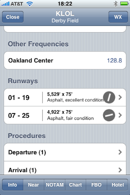
Entering the airport in which you're interested will display information on the runways and airport facilities. You can view an airport diagram and even add the airport to your list of favorites. If you want, ForeFlight mobile will open Google Maps and display the area in road map, satellite, or hybrid view.


By scrolling down you can access even more information on the runways, terminal procedures, sunrise and sunset, and fuel service. When you access terminal procedures (where available), you can choose to save the procedure which will allow you to display the chart when your iPhone is in airplane mode or when a data connection is otherwise unavailable.


A row of buttons at the bottom of the airport window lets you access information on nearby airports, NOTAMs, and see the airport displayed on a VFR or IFR chart, though you can't zoom out or scroll around on the chart. That's where ForeFlight Charts comes in. You can also get FBO information and find a hotel.


Weather the Storm
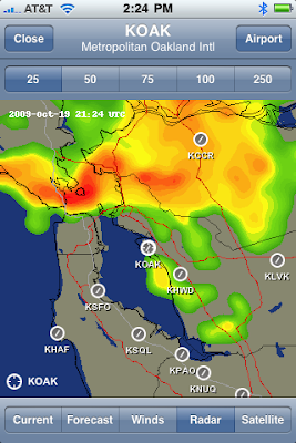
Tap on the WX button in the upper right corner and you can access current and forecast weather for that airport and the surrounding area. This brings up one of the best ForeFlight Mobile features - animated color radar images. Here's a snap of a particularly nasty rain storm that rolled through the Bay Area last Monday, which by the way the forecasters totally blew. No I wasn't flying that day, but I did need to walk my dogs!


If you select an airport that has no weather reporting, ForeFlight Mobile will automatically display the current and forecast weather for the nearest airport or airports. Note the convenient color-coding for VFR, IFR, and low IFR.


Get the Big Picture
Back on the main screen, you can also access national or international weather imagery.


Staying in the Loop
When the data that ForeFlight uses needs to be updated, you'll see a red number superimposed over the app's icon. You access the download feature from the "More ..." button. You best have a WiFi connection (not 3G) when you choose to update ForeFlight data.


So is it a "Real" Briefing?
Pilots often ask me when a preflight briefing is considered "official" and does a ForeFlight Mobile briefing put them in compliance with 14 CFR 91.103; Namely, becoming "... familiar with all available information ..." That's a tough question, only made tougher by all the excellent sources of aviation weather information out there.

For their part, the folks at ForeFlight have announced that parts of ForeFlight Mobile have received Qualified Internet Communications Provider (or QCIP) approval from the FAA. Apparently the advisory circular that describes QCIP approval is a bit vague. It also appears this AC hasn't been updated in 8 years.

So the best advice I can offer to pilots out there is to get the most complete picture of the weather that you can using all available sources, then cover your fundament and get a briefing from FSS, DUAT, DUATS, or FltPlan. Doing this last step will ensure that there is a record of your briefing, should something not work out the way you wanted or planned.

Wednesday, October 14, 2009

TFR Musings


For the first time in quite a while, my teaching schedule will be affected by a presidential TFR and I feel the urge to get on my soapbox. I accept the government's authority to use airspace restrictions to protect VIPs, that I will lose a day's worth of income, and that I will not be compensated for my loss. To add insult to injury, the way the TFRs are defined and disseminated is, quite simply, ridiculous.

Now in fairness, the TFR system has improved in the last few years. For one thing, the FAA now actually charts the restricted areas on a map, but there is still room for considerable improvement. You can go to the FAA's website to look up TFRs, though the site contains a disclaimer saying that the descriptions may be incomplete.

The TFR that will affect the Bay Area has four - count 'em! - components covering two different areas and four different effective times.
FDC 9/4760 ZOA PART 1 OF 4 FLIGHT RESTRICTIONS SAN FRANCISCO, CA, OCTOBER 15-16, 2009 LOCAL. PURSUANT TO 49 USC 40103(B), THE FEDERAL AVIATION ADMINISTRATION (FAA) CLASSIFIES THE AIRSPACE DEFINED IN THIS NOTAM AS 'NATIONAL DEFENSE AIRSPACE'. PILOTS WHO DO NOT ADHERE TO THE FOLLOWING PROCEDURES MAY BE INTERCEPTED, DETAINED AND INTERVIEWED BY LAW ENFORCEMENT/SECURITY PERSONNEL. ANY OF THE FOLLOWING ADDITIONAL ACTIONS MAY ALSO BE TAKEN AGAINST A PILOT WHO DOES NOT COMPLY WITH THE REQUIREMENTS OR ANY SPECIAL INSTRUCTIONS OR PROCEDURES ANNOUNCED IN THIS NOTAM:

A) THE FAA MAY TAKE ADMINISTRATIVE ACTION, INCLUDING IMPOSING CIVIL PENALTIES AND THE SUSPENSION OR REVOCATION OF AIRMEN CERTIFICATES; OR

B) THE UNITED STATES GOVERNMENT MAY PURSUE CRIMINAL CHARGES, INCLUDING CHARGES UNDER TITLE 49 OF THE UNITED STATES CODE, SECTION 46307; OR

C) THE UNITED STATES GOVERNMENT MAY USE DEADLY FORCE AGAINST THE AIRBORNE AIRCRAFT, IF IT IS DETERMINED THAT THE AIRCRAFT POSES AN IMMINENT SECURITY THREAT.

PURSUANT TO TITLE 14, SECTION 91.141 OF THE CODE OF FEDERAL REGULATIONS, AIRCRAFT FLIGHT OPERATIONS ARE PROHIBITED:
END PART 1 OF 4


Okay, okay, we get it. Don't violate the TFR or bad things will happen, up to and including being shot out of the sky, but does this actually need to be stated each and every time a restriction is posted? At least put it at the end of the NOTAM, because the effect of having it appear at the beginning of each and every TFR is, well, mind-numbing. So skip over the obvious stuff and then we get to the meat of the TFR that describes the affected areas and the effective times of the TFR:
FDC 9/4760 ZOA PART 2 OF 4 FLIGHT RESTRICTIONS SAN FRANCISCO, CA, WITHIN A 30 NMR OF 374600N/1222320W OR THE OAK270008.2 UP TO BUT NOT INCLUDING 18000 FT MSL.
EFFECTIVE 0910152350 UTC (1650 LOCAL 10/15/09) UNTIL 0910161705 UTC (1005 LOCAL 10/16/09). WITHIN A 10 NMR OF 373720N/1222131W OR THE SFO060000.7 UP TO BUT NOT INCLUDING 18000 FT MSL.
EFFECTIVE 0910152350 UTC (1650 LOCAL 10/15/09) UNTIL 0910160055 UTC (1755 LOCAL 10/15/09). WITHIN A 10 NMR OF 374600N/1222320W OR THE OAK270008.2 UP TO BUT NOT INCLUDING 18000 FT MSL.
EFFECTIVE 0910160020 UTC (1720 LOCAL 10/15/09) UNTIL 0910161640 UTC (0940 LOCAL 10/16/09). WITHIN A 10 NMR OF 373720N/1222131W OR THE SFO060000.7 UP TO BUT NOT INCLUDING 18000 FT MSL.
EFFECTIVE 0910161600 UTC (0900 LOCAL 10/16/09) UNTIL 0910161705 UTC (1005 LOCAL 10/16/09). EXCEPT AS SPECIFIED BELOW AND/OR UNLESS AUTHORIZED BY ATC IN CONSULTATION WITH THE AIR TRAFFIC SECURITY COORDINATOR VIA THE DOMESTIC EVENTS NETWORK (DEN):
END PART 2 OF 4


Okay, is it just me or does specifying the 0.7 DME distance from the SFO VOR seem just a wee bit precious? And why do they specify the upper limit as 18,000 feet at the beginning and the state it again, four times? Much of the complication comes from the unimaginative idea that the inner ring of the TFR must follow the VIP and be centered on their every move. When a VIP lands at an airport and then travels 10 or 15 miles to a fundraising event, having the TFR explicitly move with them needlessly complicates the restriction and probably just increases the likelihood that someone might mistakenly violate the restriction.

For crying out loud, just create one outer ring and one inner ring, centered on an easily identified landmark (like the SFO VOR), and make it big enough to account for the VIP's movements. In other words, KISS - Keep It Simple. I'll get off my soapbox now, as if anyone is listening.

I won't bore you by posting the remaining two components of the TFR. If you're going to fly on Thursday or Friday of this week in the SF Bay Area, get a preflight briefing - don't rely on my observations. And if you are a self-employed pilot or flight instructor who loses income due to these TFR, I'll leave you with the words of the late John Ciardi "May you stay solvent by whatever means are available to you."

Wednesday, July 29, 2009

Bermuda Triangle


Pilots often think the real work surrounding flying begins once they are airborne, probably because taxiing for takeoff or after landing usually doesn't seem very demanding, interesting, or dangerous. Some of my more harrowing moments in airplanes have occurred during ground operations and the years have taught me that planning, organization, and situational awareness on the ground during single pilot operations can be just as critical as when you're airborne.

The FAA, recognizing the importance of safe ground operations, has published AC 91-73A: Part 91 and Part 135 Single-Pilot Procedures During Taxi Operations, which divides single-pilot ground operations into planning, situational awareness, written taxi instructions, radio communication, and finally taxiing itself. It's a pretty good read, especially for seasoned pilots who may have become a little complacent, and it got me thinking of some of the more memorable experiences I've had while I was just taxiing.

Standardization

The AC suggests that pilots use SOPs (standard operating procedures) which should be introduced during initial training, applied during each flight, and evaluated during recurrent training. The problem is that GA pilots whose initial training was accomplished under part 61 often have little exposure to SOPs, other than their instructor's biases and what they see other pilots do. My wife says that dogs mostly learn bad habits from other dogs and the same could be said for pilots, so here are some recommended practices for single pilot ground operations.
  • Get a briefing and check for NOTAMs
  • Write down taxi instructions
  • Have the airport diagram out and refer to it
  • Avoid distractions during taxi, like programming the GPS
  • If reading a checklist, hold it up so your peripheral vision is outside
  • If confused about your taxi clearance, get clarification
  • Don't be bashful about asking for progressive taxi instructions
  • Expect the unexpected at non-towered airports, even on the ground
Have a Plan

Before calling for taxi, especially at an unfamiliar airport, it's good to review the airport diagram and mark any NOTAMs for taxiway or runway closures or other changes. Listen to the surface weather (ATIS, ASOS, or AWOS) to determine which runways are in use and look at the airport diagram and estimate the best route to the departure runway. That way when you get your taxi clearance, you'll more likely actually understand it. Jeppesen, for their part, marks hot spots on their airport diagrams and even includes some description of why the areas require special attention.

At larger towered airports, the airport diagram will list all the various clearance delivery, ground, and tower frequencies that you'll need to use. If I had a dollar for every time a pilot asked me what a particular frequency was, I might be sitting on a warm beach, sipping a cool beverage.

Becoming a Literate Pilot

As pilots gain experience I've noticed that many tend to skip the step of writing down the taxi instructions they receive, mistakenly thinking that this is what experienced pilots do. Writing down taxi clearances is easy, especially if you always do it as part of your own personal SOPs.


One morning I called for taxi and got a much more complicated clearance than I had expected. I was used to hearing "taxi runway 28 left via Alpha" but instead was given "taxi 28 left via Delta, Zulu, and Zulu One, hold short 28 right."


A recent change to ATC procedures requires ground controllers to specify the taxiways leading to your departure runway. I heard a pilot recently ask a controller if they had to read back the route, as if it were really that much trouble to do so. I often marvel at how some pilots expend considerable energy in seeing how much they can get away without doing rather than just doing what they know they should.

Be careful that you don't mistakenly hear, write, and read-back the taxi clearance you expect to get. If you read back the incorrect clearance, the controller may not catch your error, hearing what they expected you to say (sometimes called a hear-back error).

Mental Picture

Referring to your airport diagram during taxi can help keep you from making a wrong turn, but it's not foolproof. And don't rely on the ground controller to keep you out of trouble, as witnessed by this takeoff accident where a combination of factors led to the crew taking off on the wrong runway with disastrous results.

I've learned to be especially alert when I hear one controller working both the tower and ground frequencies, which is routinely done at my home airport later in the evening. While I understand that staffing considerations may drive these practices, it carries additional risks for pilots operating on the ground.

One night I called for taxi from the fuel island to parking. I received and read back my clearance. As I began taxiing, I noticed a Lear rolling out on the runway adjacent to my taxiway, both of us approaching a particularly confusing intersection of taxiways locally known as "The Bermuda Triangle." As the Lear taxied off the runway, I heard only the tower's side of the conversation as he was working both tower and ground while the Lear crew was still on the tower frequency. Keep in mind that the Lear and I were the only two aircraft on the field.

I heard the tower say "Lear 123, taxi to parking." After a pause, I heard the tower say "You can take either route" and I knew it wasn't good. Sure enough, the Lear crew chose the route that brought them straight at me - at a high rate of speed I might add. The controller had not said a word to either of us about the other. Sensing a collision was imminent, I turned on my strobes, added power, and sped past just as the Lear's wingtip missed the end of my plane by what I estimate was less than 10 feet. There wasn't any time to say anything on frequency and since the Lear was still on tower and I was on ground, it wouldn't have helped anyway. I have no idea if the Lear crew even saw me.

Eyes Peeled

Several years ago another pilot and I narrowly avoided being hit by another aircraft while doing our engine run-up. The preflight and taxi had been uneventful, but during the engine runup we noticed an anomaly in one of the cylinder head temperature indications. This led us to stay in the runup area longer than usual as we tried to figure out what was causing the high reading. The longer the engine ran, the more the cylinder head temperatures normalized. To fly or not to fly?

We had just resolved to stay in the pattern and watch the engine closely when I caught a glimpse of the aircraft that was headed straight for us. It was a home-built, tailwheel aircraft and I found myself asking aloud "Why is he taxiing so damn fast?" followed by "Jesus, he's not going to stop!" I was certain he would hit us, but at the last moment he jammed on his brakes. This raised the tail of his plane into the air, buried his prop in the pavement, and his craft slid to a stop on it's nose just short of our propeller. We told the ground controller we'd had a near collision in the runup area, that we'd be exiting our aircraft, and that we'd remain clear of the taxiway. The other pilot apologized and confessed he was headed into the sun and hadn't see us.

Speak Up

If you see a conflict unfolding that the ground controller is not aware of, it's critical to say something on the frequency. I frequently see pilots seem to just freeze in these circumstances and wonder why this is so. Perhaps it's because pilots feel intimidated by controllers or mistakenly believe they must always follow their instructions, even if those instructions are going to put their aircraft in harm's way.

Taxiing out for takeoff a few weeks ago, I heard a Gulfstream call for taxi, too. We got our clearance, joined the taxiway and headed to the run-up area. The Gulfstream got their clearance to the South Field and ended up behind us, taxiing in the same direction. That's when we heard a 727 taxiing from the South Field switch to the North Ground frequency. The 727 was ultimately going to be headed in the opposite direction. I knew there was time for us to get into the run-up area and get out of the way, but the ground controller now had a conflict between the Gulfstream and the 727. The controller ended up having the Gulfstream do a 180 degree turn on the taxiway, then taxi onto an adjacent runway so the 727 could pass. And I was glad that we had gotten our little plane well downwind of all the jet blast!

On another occasion, I was taxiing with a student to a local FBO's ramp as a Global Express on the same ramp called for taxi. Ground told him to wait and pass behind us, but I didn't like how that was going to unfold: We'd end up parked right where his jet blast was going to be as he powered up to taxi out. So I suggested to ground that we hold our position on the taxiway a hundred or so yards away and let the bigger guy taxi out, which worked out to be a much better solution for everyone.

Approach Briefing

When you brief your approach to an airport, don't forget to think about where you're going to head once you're clear of the runway. This is a good time to get your airport diagram ready and review what your desired taxi route will be. Don't forget to consider any NOTAMs included on the ATIS you recorded. You did listen to the entire ATIS, right?

Post-Flight & Good Night

You can make your ground operations safer by developing your own SOPs, writing down your taxi clearances, having the appropriate charts available, and thinking ahead. And if something doesn't look right, speak up. You just might prevent some bent metal, cracked composite, or worse.

Wednesday, March 14, 2007

Taking Notice

ATC: Cessna 123, say your route of flight.

Cessna 123: Ah ... we're going to do a Bay Tour, fly over the Golden Gate, and then head up the coast to Little River.

ATC: Cessna 123, are you aware of the temporary flight restriction today over San Francisco Bay due to the Blue Angels practicing?

Cesslna 123: Ah ... no, we didn't know there was a TFR.

ATC: Cessna 123, suggest a heading of 330 and that you remain East of interstate 80 to remain clear of the restricted area.


I cringe whenever I hear a pilot confess on the air to ATC that they didn't know about a TFR or some other sort of Notice to Airmen (NOTAM), but I'm not surprised. I feel sorry for these confused pilots because, while it is every pilot's responsibility to become familiar with all information concerning their flight, frankly the NOTAM system in the United States is one big mess. While wading through this mess, it's easy to overlook an important NOTAM among the sea of irrelevant NOTAMs.

NOTAMs are supposed to help pilots by telling them something important is happening, when it will happen, and for how long it will be happening. NOTAMs are categorized as Local, Distant, and FDC (Flight Data Center).

Local NOTAMs generally deal with events at an airport, such as personel and equipment working near a runway, taxiway closures, or some other fact related to that airport.

Distant NOTAMs deal with outages or events that could affect arriving or departing flights, such as a navigation aid being out of service, an airport's runway being closed, or an ATC radar outage.

FDC NOTAMs cover a lot of things, mostly related to changes to published charts or procedures, such as a change to a decision height on an instrument approach, the elimination of an approach, additional equipment required for an approach, or a particular route on an airway no longer being authorized.
Unfortunately, these categories do not really make it easier for pilots to digest all the NOTAMs they might get from DUAT or DUATS briefing.

I have one, simple idea that would make this unwieldy system easier to digest: Categorize NOTAMs as IFR or VFR so than VFR pilots don't have to wade through all changes to instrument approach, arrival and departure procedures. I mean really, these amendments to instrument procedures make up more than half the NOTAMs on any given day in my area. This shoud be pretty easy to do - just filter out any NOTAM that starts with "USD" or "UAR" and that would reduce this output:
NOTAMS
USD 02/051 OAK MARINA FOUR DEPARTURE.
DEPARTURE ROUTE DESCRIPTION: LINDEN, SACRAMENTO, AND SCAGGS
ISLAND TRANSITIONS NOTE: IF UNABLE TO COMPLY WITH MINIMUM ATC
CLIMB RATE OF 610 FEET PER NM TO 11000/WOODSIDE (OSI) VORTAC
R-028/24 DME, ADVISE ATC PRIOR TO DEPARTURE.
ALL OTHER DATA REMAINS AS PUBLISHED.
SFO 03/013 SFO 1R/19L CLSD 1100-1330 DLY WEF 0703131100-0703151330
SFO 03/014 SFO 1L CLSD LDG 0600-1400 DLY WEF 0703130600-0703161400
SFO 03/015 SFO 28R LDA OTS WEF 0703142130-0703150100
SFO 03/016 SFO 10L/28R CLSD WEF 0703161100-0703161400
USD 03/107 SFO SHORLINE ONE DEPARTURE...
RWY 28L/R, FOR OBSTACLE CLEARANCE A MINIMUM OF 499 FEET PER NM TO
2100 FEET IS REQUIRED.
LINDEN TRANSITION: CLIMB VIA OAK R-040 AND LIN R-240 TO LIN VORTAC.
CROSS OAK R-040 8 DME FIX AT OR ABOVE 7000. THENCE VIA (ASSIGNED
ROUTE).
ALL OTHER DATA REMAINS AS PUBLISHED.
USD 05/025 SFO EUGEN FIVE DEPARTURE...
NOTE: RWY 1L/R, FOR OBSTACLE CLEARANCE A MINIMUM CLIMB OF 233 FEET
PER NM TO 2500 FEET IS REQUIRED
USD 06/159 SFO REBAS THREE DEPARTURENOTE...
RWY 28L/R, FOR OBSTACLE CLEARANCE A MINIMUM CLIMB
OF 449 FEET PER NM TO 2100 IS REQUIRED.
UAR 09/005 SFO YOSEM ONE ARRIVAL...
YOSEM ONE ARRIVAL AVAILABLE VIA ATC ASSIGNMENT ONLY WEF 0609281300
USD 09/182 SFO QUIET TWO DEPARTURE CHICO TRANSITION NA.
RWY 28L/R, FOR OBSTACLE CLEARANCE A MINIMUM CLIMB OF
499 FEET PER NM TO 2100 FEET IS REQUIRED.
PAO 03/001 PAO TOWER UNKN (377 AGL) 2.5 N UNLGTD (ASR UNKN)
TIL 0703281400
PAO 03/002 PAO TOWER 411 (400 AGL) 2.9 NW LGTS OTS (ASR UNKN) TIL
0703282213
CCR 02/002 CCR 19R KANAN NDB/ILS LO OTS
CCR 12/004 CCR 19R ALS PCL OTS EXC MED INTST CONT
OAK 10/062 HAF AWOS CMSN 127.275/650-728-5649
LVK 03/002 LVK 25R ILS OTS WEF 0703141800-0703142000
USD 03/015 SJC ALTAM SEVEN DEPARTURE NOTE: RWY 11, 12L/12R,
TEMPORARY CRANE 1.4 NM FROM DEPARTURE END OF RWY 12L, 26 FEET LEFT
OF CENTERLINE, 227 FEET AGL/308 FEET MSL.
ALL OTHER DATA REMAINS AS PUBLISHED.
USD 03/016 SJC SUNOL SIX DEPARTURE NOTE: RWY 11, 12L/12R, TEMPORARY
CRANE 1.4 NM FROM DEPARTURE END OF RWY 12L, 26 FEET LEFT OF
CENTERLINE, 227 FEET AGL/308 FEET MSL.
ALL OTHER DATA REMAINS AS PUBLISHED.
USD 03/017 SJC MOONY TWO DEPARTURE TAKE-OFF MINIMUMS: RWY 12L/12R
STANDARD WITH A MINIMUM CLIMB OF 290 PER NM TO 4700.
NOTE: RWY 11, 12L/12R, TEMPORARY CRANE 1.4 NM FROM DEPARTURE END OF
RWY 12L, 26 FEET LEFT OF CENTERLINE, 227 FEET AGL/308 FEET MSL.
ALL OTHER DATA REMAINS AS PUBLISHED.
USD 03/018 SJC DANVILLE TWO DEPARTURE NOTE: RWY 11, 12L/12R,
TEMPORARY CRANE 1.4 NM FROM DEPARTURE END OF RWY 12L, 26 FEET LEFT
OF CENTERLINE, 227 FEET AGL/308 FEET MSL.
ALL OTHER DATA REMAINS AS PUBLISHED.
SJC 12/015 SJC 12R/30L RCLL OTS
APC 03/007 APC TOWER UNKN (200 AGL) 1.5W LGTS OTS (ASR UNKN) TIL
0703202359
APC 03/012 APC TOWER 176 (52 AGL) 1.36 ENE LGTS OTS (ASR 1240396)
TIL 0703261344
RHV 03/001 RHV TOWER 1435 (302 AGL) 7.71 SSE LGTS OTS (ASR 1055723)
TIL 0703220641
USD 01/107 VCB SOKOY ONE DEPARTURE TAKE-OFF MINIMUMS: RWY 2, 300-1
NOTE: RWY 2, TEMPORARY CRANE 3130 FEET FROM DEPARTURE END OF RWY,
189 FEET RIGHT OF CENTERLINE, 250 AGL/342 MSL. ALL OTHER DATA
REMAINS AS PUBLISHED.
RIU 03/005 F72 TOWER 1549 (1549 AGL) 4.85 SSW LGTS OTS (ASR
1012855) TIL 0703171625
OAK 03/022 2O3 FUEL UNAVBL TIL 0703161400
OAK 03/014 1C9 5/23 RWY LGTS OTS
SAC 03/013 SAC 16/34 CLSD WEF 0703131900
RIU 03/029 3O1 TOWER 391 (311 AGL) 6.55 NE LGTS OTS (ASR 1015154)
TIL 0703290916
SMF 03/013 SMF 16R ILS CAT 2/3 NA
SMF 03/014 SMF 16R ILS GP/LLZ OTS WEF 0703141400-0703141700
UAR 05/003 SMF TUDOR ONE ARRIVAL.
CHANGE ALL PLANVIEW REFERENCES TO FINAL APPROACH COURSE TO 165.74
DEGREES.
SMF 10/014 SMF 34L ILS MM DCMSND
MRY 03/002 MRY CCSA 1300-0400 DLY
MRY 03/003 MRY TWR 1300-0400 DLY
RIU 01/044 CPU CTAF NOW 123.0 VICE 122.8
MER 02/001 MER TWR 1500-0500 DLY PLUS SEE AFD
MER 02/002 MER CDSA AVBL 1500-0500 DLY
RIU 03/023 O61 TOWER 2523 (500 AGL) 6.93 ESE LGTS OTS (ASR 1011405)
TIL 0703271626
OAK 12/038 1O2 LOP NDB OTS
MYV 02/004 MYV 14 ILS GP UNUSBL CPD APCH BLW 576
MYV 03/002 MYV MARYSVILLE RCO 122.6 OTS
RIU 03/001 HNW RCO 122.1 OTS
RIU 05/017 E45 RTR 121.25 VICE 126.85
RIU 03/026 F34 TOWER 303 (162 AGL) 1.22 NNW LGTS OTS (ASR 1000095)
TIL 0703280123
GPS 03/005 ZOA GPS UNREL AND MAY BE UNAVBL WI A 320 NM RADIUS OF
NAWS CHINA LAKE/ARMITAGE AP (NID, 354116N/1174126W) AT FL400. THIS
AREA DECREASES WITH ALT TO A CIRCLE OF 267 NM RADIUS FROM NID AT
FL250, 212 NM RADIUS AT FL100, AND 191 NM RADIUS AT 4000 FT AGL.
THE IMPACT AREA ALSO EXTENDS APPROX 80 NM INTO MEXICAN AIRSPACE
TO THE SOUTHWEST, SOUTH AND SOUTHEAST OF THE CALIFORNIA BORDER FROM
APPROX FL150-FL400 WEF 0703152100-0703160001
GPS 03/015 GPS PRN 24 OTS WEF 0703151700-0703161900
GPS 08/045 GPS PRN 15 OTS WEF 0608211425

To this (for VFR pilots):

NOTAMS
SFO 03/013 SFO 1R/19L CLSD 1100-1330 DLY WEF 0703131100-0703151330
SFO 03/014 SFO 1L CLSD LDG 0600-1400 DLY WEF 0703130600-0703161400
SFO 03/016 SFO 10L/28R CLSD WEF 0703161100-0703161400
SJC 12/015 SJC 12R/30L RCLL OTS
APC 03/007 APC TOWER UNKN (200 AGL) 1.5W LGTS OTS (ASR UNKN) TIL
0703202359
APC 03/012 APC TOWER 176 (52 AGL) 1.36 ENE LGTS OTS (ASR 1240396)
TIL 0703261344
RHV 03/001 RHV TOWER 1435 (302 AGL) 7.71 SSE LGTS OTS (ASR 1055723)
TIL 0703220641
RIU 03/005 F72 TOWER 1549 (1549 AGL) 4.85 SSW LGTS OTS (ASR
1012855) TIL 0703171625
OAK 03/022 2O3 FUEL UNAVBL TIL 0703161400
OAK 03/014 1C9 5/23 RWY LGTS OTS
SAC 03/013 SAC 16/34 CLSD WEF 0703131900
RIU 03/029 3O1 TOWER 391 (311 AGL) 6.55 NE LGTS OTS (ASR 1015154)
TIL 0703290916
SMF 03/014 SMF 16R ILS GP/LLZ OTS WEF 0703141400-0703141700
MRY 03/002 MRY CCSA 1300-0400 DLY
MRY 03/003 MRY TWR 1300-0400 DLY
RIU 01/044 CPU CTAF NOW 123.0 VICE 122.8
MER 02/001 MER TWR 1500-0500 DLY PLUS SEE AFD
MER 02/002 MER CDSA AVBL 1500-0500 DLY
RIU 03/023 O61 TOWER 2523 (500 AGL) 6.93 ESE LGTS OTS (ASR 1011405)
TIL 0703271626
OAK 12/038 1O2 LOP NDB OTS
MYV 03/002 MYV MARYSVILLE RCO 122.6 OTS
RIU 03/001 HNW RCO 122.1 OTS
RIU 05/017 E45 RTR 121.25 VICE 126.85
RIU 03/026 F34 TOWER 303 (162 AGL) 1.22 NNW LGTS OTS (ASR 1000095)
TIL 0703280123
GPS 03/005 ZOA GPS UNREL AND MAY BE UNAVBL WI A 320 NM RADIUS OF
NAWS CHINA LAKE/ARMITAGE AP (NID, 354116N/1174126W) AT FL400. THIS
AREA DECREASES WITH ALT TO A CIRCLE OF 267 NM RADIUS FROM NID AT
FL250, 212 NM RADIUS AT FL100, AND 191 NM RADIUS AT 4000 FT AGL.
THE IMPACT AREA ALSO EXTENDS APPROX 80 NM INTO MEXICAN AIRSPACE
TO THE SOUTHWEST, SOUTH AND SOUTHEAST OF THE CALIFORNIA BORDER FROM
APPROX FL150-FL400 WEF 0703152100-0703160001
GPS 03/015 GPS PRN 24 OTS WEF 0703151700-0703161900
GPS 08/045 GPS PRN 15 OTS WEF 0608211425

Maybe someone is listening ... but probably not.
Related Posts Plugin for WordPress, Blogger...