Showing posts with label XM weather. Show all posts

Monday, January 17, 2011

Foggy Inland, Clear at the Coast

Known for it's microclimates, the San Francisco Bay Area weather is a year-round marvel. In the summertime, with little moisture in the Central Valley, the sun often beats down mercilessly on the earth, that in turn heats the air near the surface, the air expands and rises, resulting in an area of thermal low pressure. The summertime pressure gradients between cool, moist coastal areas and the hot, dry Central Valley can be dramatic: It's not uncommon to see a barometric pressure difference of 0.1" Hg or greater between Oakland and Byron, a mere 29 miles away. With the Santa Cruz and Diablo Mountain ranges acting as low altitude barriers, the strong on-shore pressure gradient draws the famous San Francisco fog Eastward, through the Golden Gate and into the bay and other low lying areas.

Winter in The Valley
In the winter months, the effect can be just the opposite. Surface moisture from heavy rainfall combines with low surface temperatures and light winds to form Tule fog in the Central Valley (this is really just a regional term for radiation fog). Add a high-pressure system like the one currently ensconced over North Central California, and you get a temperature inversion that makes the Tule fog persist for days, even weeks. Winter months can often provide an off-shore surface pressure gradient that is just the opposite of the summer pattern. The result is the Tule fog in the Central Valley can be drawn Westward into the Livermore Valley and even into San Francisco Bay.

One benefit of this winter fog pattern is that instrument pilots can depart under visual flight rules (VFR) from Bay Area airports, fly just a few miles to one of several Central Valley airports, and experience instrument approaches to minima - often less than 1/2 mile visibility with indefinite ceilings of 200 feet or less with calm winds. With widespread low IFR, wise pilots and instructors carefully weighs the risks associated with practicing instrument approaches under these conditions.

Seeing an ocean of Tule fog sitting in the Central Valley, but with warm temperatures and clear blue skies aloft is a great way to teach pilots and non-pilots that this type of fog does not burn off. Tule fog will mix into the upper atmosphere and dissipate once the surface winds increase. I still cringe when I hear pilots and weather forecasters (folks who should know better) talk about radiation fog burning off. D'oh!

Here are some recent photographs of Tule fog from above. Having grown up in the Midwest, I'll take Tule fog over sub-zero temperatures and snow shovels, thank you very much.

East of Lake Berryessa

Widespread Low IFR

Tule Fog pilled up behind the Devil's Mountain

Procedure Turn Inbound at KEDU.

Ripples near Rio Vista
There's an airport down there ... somewhere


Tuesday, November 11, 2008

Exposé

Many pilots compare a trip to an aviation trade show as like being a kid in a candy store. I know at least one pilot who consciously leaves his credit cards at home so he won't buy something on impluse. This past weekend was the first AOPA Expo event I attended. Held at the San Jose Convention Center, with a static display of aircraft at nearby Mineta San Jose International Airport, I heard around 6,000 people attended the event. After a hour or so in the exhibit hall, I got that geeked-out feeling, like when I've done too much holiday shopping. That's when things start to look like this.


The exhibit hall contained a dizzying array of gadgets, accessories, aircraft, and simulators, but I had a plan: I had identified a few things I definitely wanted to see. And along the way, I ran into some unexpected discoveries.

The first stop for me was the Jeppesen booth where I wanted to look at and purchase the recently released VFR+GPS area charts for San Francisco and Los Angeles as well as the sectional-scale charts for Northern and Southern California. I tried to buy these on-line earlier the previous week at Jeppesen's web site, but their site has been recently redesigned and has plenty of kinks that need to be worked out. I struggled with it for 15 minutes, then decided I'd just buy the charts at Expo and save on the shipping costs.

Overall, I like these charts. I received belated permission from Jeppesen to show excerpts of these charts after my previous post. These charts are easier to read than FAA sectionals and area charts, but there are some minor annoyances. To their credit, the representatives at Jeppesen seemed receptive to the suggestions they were receiving, they seem intent on improving these charts, and they plan to eventually provide coverage for the entire US.

Next stop was the Garmin booth. I played with a G1000 with synthetic vision that was designed as a King Air retrofit. The simulator was running, the closest airport was Ely, Neveda, so I proceeded to the initial approach fix for the RNAV RWY 18 approach. I mostly wanted to play with the flight director/autopilot, but the synthetic vision features were interesting, too.


I definitely like the magenta boxes - the highway in the sky feature - but none of the fixes were highlighted. In the Chelton version of highway-in-the-sky, each fix or waypoint appears on the display as a "tethered balloon" through which you fly. That's a great way to help the pilot keep 3D situational awareness.

There was a big crowd around the new 696, but I found this new unit mostly disappointing. The 696 and 695 seem to me to be electronic flight bags, first and foremost, with XM weather thrown in. I could imagine many corporate flight departments lining up to by them so their flight crews would not have to haul around 40 pounds of approach chart binders. The price point for this unit (over US$3000) puts it out of reach for most GA pilots, who are probably going to purchase a 396 or 496 and carry paper charts. Add the XM weather subscription and the US$400+ annual subscription for NACO charts and you have a hefty price tag that keeps on tugging at your wallet.

Though the 69X form factor is larger than the 396 and 496, I didn't find the approach chart display to be very easy to read - even with my reading glasses on. The Garmin folks told me there weren't any plans to support Jepp charts while the Jepp representatives told me the opposite. Either way, the current approach chart display does not provide a geo-referenced display of the aircraft's position on the approach. I understand that there are technical reasons that make a geo-referenced display difficult, but that is a feature that pilots expect from an electronic chart display and it's something that should be addressed.

Garmin had a chance to replicate the knobs and button used in the G1000 flight plan feature, or at least keep a similar user interface policy. Instead, the designers chose to create a similar looking interface that is actually very different: You use the joystick on the G1000 to move around the map display and to zoom in or out. On the 69X, you use the joystick to make menu selections and there is a separate range rocker switch.

While I don't see many GA pilots having interest in the 69X series, Garmin should nevertheless be commended for getting into the EFB market. Unlike most other EFB implementations currently available, Garmin has a reputation for creating stable hardware and software. I'd expect the 69X series to be just as reliable. Time will tell.

The Cessna Skycatcher looked too uncomfortable to crawl into, but eventually I did contort my average five foot eleven inch frame into the right seat. I'm still amazed the plane won't be IFR certified nor will it be certified for spins. I discussed this with a Cessna representative and he seemed interested in my comments and observations. The ballistic parachute will be located in part of the baggage compartment. I assume the solid motor rocket will eject the parachute package through the plastic window that makes up the roof of the baggage compartment. I bet deploying the cute will create enough noise to really get the pilots' attention! The cockpit doors hinge from the top and if they can be opened in flight, it should allow for some nice aerial photo possibilities.


The Cessna representative assured me that the aircraft has recovered from spins in all sorts of center-of-gravity loadings, but I was struck by the small surface area of the rudder when compared to a C150 or C152.

I eventually sat in the Diamond, Cirrus and Piper Jet mock-ups - yawn! I chatted with the Cirrus rep and he was receptive to my comments about the way they have structured CSIP, so I let him play with the X-Plane Cirrus jet model on my iPhone.

The Bendix/King booth had a nice display of their new Av8tor hand-held GPS and their soon-to-be-released GPS/Com/Nav units. I chatted with them about the Av8tor user interface, which one of the pilots I fly with purchased a few months ago. Though the Av8tor may not be as sexy as the equivalent Garmin hand-held GPS, at least Bendix-King has gotten the price-point right. You can purchase an Av8tor without XM weather for a fraction of the cost of a comparable Garmin unit. And you can add XM weather capability later and still save a wad of dough. Kudos to Bendix-King for thinking of the GA pilot's wallet: Few other manufacturers seem to be doing so.

Many of my readers know that I'm a fan of diesel engines, so I just had to visit the Thielert booth to see their Centurion 2.0 and 4.0 engines on display. The representative was deftly fielding constant questions about the company's recent emergence from bankruptcy and the status of their relationship with Diamond Aircraft and Cessna. But what struck me was the sheer size and weight of these engines. They looked massive and though they offer outstanding fuel economy, the acquisition and maintenance costs seemed quite high.


The Rolls Royce booth provided a real contrast to the Thielert. Their RR500 direct-drive turboprop engine is being marketed as a retrofit for high performance single-engine aircraft. I'm not sure how the cost compares with a comparable Centurion engine, but the 2000 hour interval before hot section inspection seems more reasonable than replacing a diesel engine's gear box every 300 hours. If the Thielert Centurion engines looked heavy, complicated and massive, the Rolls Royce turbo-prop looked small, elegant, simple, powerful, and bullet-proof. I'm not that fond of direct-drive turbo-props, but if I had my jet-A druthers and my wallet was big enough, I'd fly behind a Rolls Royce RR500 any day of the week.


I left this year's Expo with my wallet intact, having only spent money on parking and a bite to eat. I ran into dozens of Bay Area pilots as well as several friends who flew in from points far away. I got to see lots of cool toys and it was certainly worth the freeway traffic and the cost of entry.

Tuesday, June 17, 2008

Caribbean Conclusions

At the end of any trip comes the inevitable realizations about lessons learned as well as the comparisons and contrasts. Before I get to that, I'd like to ask readers who find my blog useful to consider making a donation to support my continued efforts. Over the last two-plus years, I've been writing regular blog entries that I hope are informative, useful, and entertaining. Writing takes time and, well, time is money.

The amount you choose to donate is up to you and donating is easy: Use the PayPal donate button on the upper right side, though if you are using a blog reader that button might not appear. Just visit the blog directly and you'll see it. Click the PayPal button and you can securely use any credit card or your PayPal account, if you have one. To those who have contributed in the past, thank you for continuing to support my efforts.

After 4 weeks "on the road," here are my observations about radio work, position reporting, paperwork, fueling, immigration/customs, weather briefings, airport security, and GA flying versus airline flying.

Aviation Phraseology

Purists insist that rules about communication need to be followed, and to a degree they are correct. I consider myself to be a bit of a purist, by the way. Rules and accepted phrases are intended to allow pilots and controllers to communicate efficiently and prevent mistakes, but rules can't cover every situation. In spite of efforts to standardize what is said on the radio, there will be local variations and spur of the moment improvisations because rules can't cover everything. For pilots who intend to travel to the Caribbean, here are my suggestions for radio communications.

If you don't understand what a controller has said because of their accent or phraseology, don't delay responding while you try to puzzle out what they said. Instead, promptly reply with something like "I'm sorry, could you say again please, slowly ..." If you think you know what has been communicated, but are not sure, then by all means paraphrase what you have heard and don't fret too much about phraseology. Remember that the goal is communication - the exchange of meaningful information - not a stylized dance.

If you are a U.S. pilot, get used to including November in your callsign. The usual practice in the U.S. is to omit the November part of your callsign when you include your aircraft manufacturer or model. Outside the U.S., the November prefix needs to be included. You may find the habit of omitting November to be as tough to break as I did.

There often will be no radar service in the areas in which you have choosen to fly, so brush up on position reporting. A abbreviated position report format is PTA-Next, which stands for:

Position (name of the fix)
Time (in Zulu)
Altitude (or flight level)
Next fix and your estimate for reaching that fix.

This is especially useful when handed off from one ATC facility to another, for example:
Raizet approach, November 1234 Delta, MEDUS, level niner zero, 1933 Zulu, estimating TASAR at 1950 Zulu
Approaching a terminal area that has no radar, expect to be asked to report your position relative to a VOR or NDB:
Say your distance and radial from Alpha November Uniform VOR
You can preempt this request by offering it when you check in:
V.C. Bird approach, November 1234 Delta, level niner zero, 25 miles out, ANU 192 radial, information Foxtrot

During pre-flight planning and while en route, pay particular attention to FIR (flight information region) boundaries. They are depicted on Jepp and FAA IFR low altitude en route charts as well as on World Aeronautical charts. You can be prepared to provide an estimate to the FIR boundary by including the fix that falls on the boundary in your GPS flight plan, if you are GPS equipped.

You will probably be asked to "Report your estimate crossing the boundary" or "Report crossing the boundary," which mean when you think you'll cross the FIR boundary or when you are actually crossing it, respectively. Below is an excerpt from the Caribbean Low Altitude En Route Chart and you can see the blue dotted line representing FIR boundary around the Turks and Caicos. I've circled MICAS, a waypoint you might enter into your GPS flight plan if you were inbound on the airway A555.


Here are a few phrases that I got used to hearing and their U.S. equivalent:
"November 34 Delta, you are radar identified" = Radar contact.
"Say your leaving level" = Say altitude or flight level you are descending through.
"Say your passing level" = Say altitude or flight level you are climbing through.
"Backtrack runway zero seven" = Backtaxi on runway seven.
"November 34 Delta, copy ATC clearance." = IFR clearance available, advise ready to copy (Be prepared to do this while taxiing).
"I'll call you back" = Standby
Paperwork, Flight Plans, Customs

Become familiar with ICAO flight plan forms. They aren't difficult, they're just different. Both DUAT and DUATS offer HTML version of these that you can experiment with, but remember that flight plans originating outside the U.S. and its territories will need to be filed with the local ATC authority. This means you'll have to use the paper version and fax it or hand-carry it to the appropriate office.

Below is an excerpt of a DUAT ICAO flight plan form. When you specify your aircraft's equipment, start with S (for standard) and then include every other type of capability your aircraft has. The Duchess I was flying was GPS equipped with two VOR receivers, two glideslope receivers, and DME so the acronym I came up with was SD GLO. The RMK section is where you can enter remarks and I always put ADCUS, which is supposed to indicate to ATC that they should "advise customs" at your destination on your behalf prior to your arrival. Prior notification of customs is a requirement for all countries.

The part of the ICAO flight plan that references dinghy is referring to what you might know as a life raft. You'll need to put the number of life rafts, the number of people the rafts can hold, whether or not they are covered, their color, and the survival equipment it includes. Next comes emergency radio equipment, survival equipment and life jackets.

When flying in the Caribbean you are required to carry a life raft and one life jacket for each occupant. Most commercial life raft you can purchase come with a survival kit that includes signal flares and other equipment. I strongly recommend that you also have a hand-held, waterproof VHF transceiver and a 406 Mhz GPS personal emergency locator beacon. Lastly, enter your fuel endurance in hours and minutes.


Learn about General Declarations or gendecs. You can download a PDF version here. Here's an example of how you might fill one out. Be sure you have at least four copies of your inbound gendec when arriving and four copies of your outbound when departing.


Customs Handling

Though it can be costly, you can save a lot of time and hassle by contracting with a handling service if your destination is at a large airport. The handler will expedite the processing of your gendecs, get you through immigration/customs, direct you to where you pay landing and departure fees, and arrange re-fueling. Handling service charges range from $100US to as much as $250US and you can usually find the appropriate phone numbers in the Bahamas and Caribbean Pilot's Guide.

There is generally less hassle and less waiting at smaller airports of entry where you may be able to figure out your own handling without much trouble.

Landing fees and taxes are usually not payable with a credit card. Some offices accept the EC (Eastern Caribbean dollar), others want Euros or U.S. dollars, so call ahead or just always have plenty of cash with you. Larger airports usually have ATMs that may allow you to obtain the local currency.

Fuel

Fuel can be very expensive and at many smaller airports, 100 low-lead aviation gasoline is often not available. Again, check the excellent Bahamas and Caribbean Pilot's Guide for phone numbers and details.

Where fuel is available, credit cards may not be accepted and you may have to pay in cash. U.S. dollars seem to be preferred or, in some cases, required. Phone ahead to be sure fuel is available and to learn of the payment methods accepted.

I recommend supervising the re-fueling process. Afterward, always check the fuel quality carefully. I found traces of water and debris after being refueled in a couple of places. I recommend the GAT jar for sumping fuel because you can easily drain a substantial amount for a more thorough inspection.

Weather Briefing and Thunderstorms

Detailed weather data can be hard to come by in many parts of the Caribbean. METARs and TAFs (airport weather observations and forecasts) can be had through a variety of sources, but the forecasts can be annoyingly vague. Pilot reports and winds aloft forecast seem to be rare or non-existant. Here's what a DUAT output looked like for part of my trip. Not much information, is it?


Nexrad images are available for Puerto Rico, but other than the long range base reflectivity product there are no other weather radar products that I could find. Various satellite images are available and there is a high level prog chart that gives you an overall idea for the Caribbean weather patterns.

Many airports do not broadcast any surface weather conditions over the radio, but some do so over the voice portion of a VOR. The tower (if there is one) will provide you with the conditions, otherwise you are on your own.

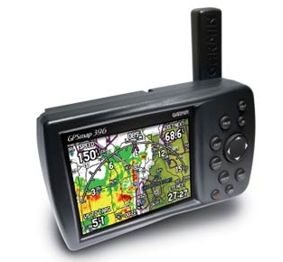
I found most thunderstorms to be isolated and easy to see and avoid, but embedded thunderstorms are possible. The XM weather feature on our hand-held Garmin 496 quit working after we left Providenciales and didn't work again until we returned to the U.S. mainland. Pilots of GA aircraft without on-board radar need to weigh their options and risks carefully. If you don't have radar or a strike finder and you can't stay in visual conditions while you maneuver around build-ups, you probably shouldn't be flying. Flying early in the morning can help you avoid most thunderstorms. If you're faced with an approaching thunderstorm, delaying your departure by only a few hours or a day may be all that's needed to substantially reduce your risk.

Get used to writing down two altimeter settings and taking note of the transition altitude for the area in which you are flying. You'll use QNH when you're below the transition altitude. Above the transition altitude you'll refer to your altitude as a flight level (or just level) and set QFE on your altimeter. Some ATC facilities see that you are a U.S. registered aircraft and provide the altimeter settings in inches of mercury as a courtesy, but don't count on it. Some altimeters display millibars and inches of mercury in separate Kollsman windows and you can set the G1000 preferences to millibars. Otherwise, you should have a millibars to inches conversion table handy.

Airport Security

I don't recall seeing armed police presence at any of the Caribbean airports I visited, save the ones in U.S. territories. Another difference between U.S. CBP and immigration/customs in Caribbean countries is the manner in which you are treated. In Caribbean countries, the authorities may search your bags, examine your travel documents, and ask you questions about your travel plans, but the people doing this are not armed and only once (in Trinidad) did I feel there might be a presumption that I was guilty until proven innocent. The U.S. TSA posts signs promising to treat you with dignity and concern, but the very fact they have to post such a sign seems intended to prepare you for just the opposite. In the countries to which I traveled, I was generally treated with respect by people who felt no need to post a sign saying that this would be the case.

Outside the U.S., pilots are referred to as "captain," a title of respect that recognizes you are in command of an aircraft. I felt U.S. Customs and Border Protection and TSA officers simply saw me as a potential threat. When they determined that I wasn't, they just dismissed me and went on to the next potential "target." Be prepared for culture shock if you re-enter the U.S. or one if its territories after spending a bunch of time in other parts of the Caribbean.

My comments and opinions are based on my firsthand experiences and it is not my intent to stir patriotic fervor or righteous indignation in my U.S. readers. If you don't like what I've said here, by all means feel free to disagree. Remember that the U.S. is (or at least was) based on the freedom to dissent, not the requirement to conform to one accepted viewpoint.

Flying Yourself versus The Airlines

Piloting an aircraft through Caribbean airspace will take longer and cost more than being transported in an airliner, but the GA route is a heck of a lot more fun and, in some cases, substantially faster.

Take our return flight from V.C. Bird airport in Antigua to San Juan, Puerto Rico on American Airlines. We arrived at 1pm for a 3:05 departure. We allowed plenty of time to get through the lines for departure tax (yes, there's a tax even for airline passengers), immigration, and security. Then we waited about an hour and a half before they began boarding the aircraft.

Near as I can tell from the cabin announcement, the 757's APU was deferred (inoperative) and we required an "air cart" (a supply of high pressure air) to start the first engine. Getting the air cart took about 30 minutes and while we waited on the ramp in the blazing sun and high humidity, we essentially had no air conditioning. The cabin crew was great. They opened a couple of doors for better ventilation and the flight crew did their best to keep us up-to-date on what was happening.

Once the air cart arrived and the engines were finally started, we had air conditioning and there was more bad news. We were already over 45 minutes late for our departure when the captain informed us there would be an indeterminate delay: The tower had informed them "something was on the runway." No one knew exactly what was on the runway, but we sat and waited, and waited, and waited. After nearly two hours of waiting on the ramp, we finally made our way to the runway for takeoff. During this time, the cabin crew handed out ice water, even though no refreshments were scheduled for what should have been a short 45 minute flight.

We never found out what was on the runway or why it took so long to clear, but I have a theory. I had landed on the same runway the day before and had noticed that two large, parallel strips of pavement at the threshold had recently been surfaced. On the landing rollout the previous evening, I could smell the fresh asphalt and oil. In addition, there was no white center line stripe for the first 900 feet or so. My theory, and it's just that, was some of that fresh pavement buckled or otherwise deteriorated. This is a plausable theory since a Virgin Atlantic 747 and some other pretty big aircraft had arrived earlier in the day. When we took the runway for takeoff, I noticed that a new white stripe had been painted since I landed the evening before.

We finally arrived at San Juan a little past 7pm, over 3 hours late. On the way, there was a loud, troubling, low-frequency buzz coming from the left engine. It changed with the power settings and was very pronounced at takeoff and climb thrust, but diminished at cruise and went away almost entirely during descent. Departing the aircraft after landing, I passed the head flight attendant and mentioned "I hope the flight crew knows about that nasty low-frequency vibration on the number one engine." He gave me a sort of dismissive smile and said "I'm sure they do, sir, I'm sure they do."

Had we flown the Duchess to San Juan, we could have arrived at the airport at noon and it is very likely that by 1pm, we would have finished the preflight, had our gendec paperwork, and our flight plan filed. The flight to San Juan would have taken about 1 hour and 45 minutes - arriving at approximately 2:45pm. After landing, clearing immigration, customs, and paying our landing fees would have taken about 45 minutes, putting us curbside at about 3:30pm which would have been 25 minutes past the scheduled departure time of our airline flight. The Duchess would have arrived nearly an hour earlier that the scheduled airline arrival at San Juan or more than 4 hours before our delayed arrival.

But you ask, how could the Duchess have departed if there was something on the runway? Well it turns out the tower was allowing intersection departures on the runway, but the takeoff distance remaining was too short for a 757. So the Duchess could have beat the airlines handily, albeit at a higher cost. Of course the airlines have more sophisticated equipment that would have made the flight safer had the weather been bad.

There ends my Caribbean Conclusions. I hope my little travelogue has been informative, interesting, and that it may encourage other U.S. pilots to explore the Caribbean themselves.

Saturday, May 17, 2008

Straighten Up and Fly Right


U.S. airport identifiers start with a K, so we enter KOAK in the GPS for Oakland.

But on the chart it just says OAK.

I know, but the GPS thinks that is the ID for the Oakland VOR, so we use the ICAO standard KOAK to refer to the airport.

Okay, so Tyler Municipal Airport is listed on the chart as T74, but we enter it in the GPS as KT74, right?

Oh, I forgot to mention that when a U.S. airport ID contains numbers, you don't prefix it with a K.

That's ridiculous! Why is there such an inconsistent convention for something so basic as an aiport's ID?

I don't know, these conventions grew up over time and now it's just the way it is.

This was just one of many exchanges between me and my wife as I prepared her to be my pinch-hitter on an upcoming cross-country flight. She's flown with me before on long trips, but it's been a while. And though she's not a pilot, she's a fast learner and is eager to assist. Helping her understand the basics of VFR charts has really underscored in my mind how hard-to-use these charts can be. At least U.S. charts are consistently hard-to-use. When we got to the charts that covered the area outside the U.S., things got really interesting.

This upcoming cross-country flight will be the longest one I've ever done and the primary purpose is to ferry an aircraft to its owner. My wife is coming along for the adventure and because she doesn't like the idea of me flying alone and without an autopilot for several days in a row. I'll be relying on her occasionally to keep the plane straight and level while I attend to some in-flight chores, to help locate the appropriate charts, to keep an eye on the handheld GPS with it's XM weather display, and to help program the panel-mounted Garmin 530 and 430 GPS receivers. We also cover in-flight emergencies, the aircraft checklist, and what she'll need to do in the unlikely event that I become incapacitated.

We covered the Garmin 530/430 knobology and while she made the usual beginner's missteps she became adept at the basics of setting communication and navigation frequencies, locating information on the nearest airports, and entering and modifying a flight plan. "Why do they make this stuff so hard to use?" she asked and I again I don't have a good answer.

How to use the supplemental oxygen system was next on the list, so we covered how to connect the cannula, and how to turn on and adjust the flow. We practiced donning our life jackets and discussed when we will wear them while inside the plane. We agreed that we'll put them before taking off for an over-water route, not take them off until we're above 5000 feet, and put them back on when beginning our descent. I'll have the waterproof, handheld radio attached to my vest and she'll have the personal GPS locator beacon attached to her vest. The life raft will be secured behind her seat, where I can reach it should be have to ditch in the ocean.

I'm always extra careful when flying an aircraft that has just been approved for return to service by the mechanics. It's not that I don't trust mechanics, I just know that aircraft maintenance is complicated and mistakes can happen. So I'll use an aircraft acceptance checklist that I created, do a very thorough preflight inspection, look for loose screws, check all the inspection plates, and I'll be the only person on board for the first flight.

On subsequent shake-down flights, I'll cover the basic aircraft engine and flight controls with my pinch hitter. But first the plane has to come back from it's annual inspection. The propellers just came back from the prop shop and have been installed, but the engine ground runs must still be completed and the aircraft logbook updated. I feel like I'm helping create a mosaic out of hundreds of tiny tiles while trying to maintain a normal teaching schedule up to our departure date. All the planning and preparation is tedious and time-consuming, but the big picture is gradually taking shape.

Sunday, October 21, 2007

Worthy of Respect


A phrase I often quote is "Experience is what you get when you don't get what you want." As an instrument instructor, I do my best to expose instrument rating candidates to real-world IFR for a variety of reasons. One reason is to reset the expectations that many pilots have about the utility of getting an instrument rating.

There is no question that instrument training makes GA pilots safer and the accident statistics back that up. Part of this increased safety is the increased skills that you must gain to earn an instrument rating. I suspect that instrument-rated pilots are safer when the weather is marginal because they are more likely to file IFR than to try to scud run and remain VFR underneath the clouds.

The FAA doesn't require an instrument rating applicant to have flown in actual instrument meteorological conditions. I suspect that many pilots get their instrument training in simulated instrument conditions (with a view-limiting device), without ever seeing the inside of a cloud or only seeing real weather for a few minutes at a time. While I try to get the pilots I train into real IMC, I often have to point out that there is weather that just isn't safe to fly in a small aircraft. I like my instrument candidates to see everything from marginal VFR to real instrument conditions with low visibility, but this isn't always possible. You can't order up rain and low visibility when you want it, though it always seems bad weather arrives when you don't want it or least expect it.

The three main deal-breakers to flying IFR in small aircraft include thunderstorms, icing, and widespread low visibility. Flying at night in instrument conditions, especially in single-engine aircraft or over mountainous terrain, needs to be scrutinized very carefully as it is inherently more dangerous and statistically more likely to be fatal if something goes wrong. When all of these factors are considered, it's obvious that instrument instructors walk a fine line between teaching how to make a no-go decision and when to decide to launch into possibly challenging weather conditions.

My decision to launch on an IFR training flight from Redding back to Oakland late last week was based on the best available information at the time. We reviewed PIREPs that were available, the forecasts, the surface weather reports, and the latest NEXRAD radar images. Thunderstorms were not forecast and the freezing level was about five thousand feet higher than we'd need to fly. The radar showed that a plume of moisture from the northwest was beginning to arrive over Redding and conditions were probably only going to deteriorate if we waited. The plane we were flying was G1000-equipped with XM weather capability, so we'd have a bit more information in flight than most small GA aircraft have.

We received our clearance and checked the XM radar. The three minute old radar image showed a band of green echoes we'd have to fly through to the south. South of Red Bluff, there were no echoes at all. We departed in moderate precipitation with visibility in the 1.5 mile range. The surface winds had decreased a bit since our arrival a few hours earlier, but were still in the 20 knot range.

Once airborne and above 1500' the winds increased to a direct headwind of 41 knots. As we checked in with Oakland Center rains became heavy and our climb rate deteriorated. Center reminded us that we were below the minimum safe altitude for that area, adding that he had an amendment to our clearance and we should advise when ready to copy. At that point the new XM radar image showed yellow to dark yellow echoes. I had to disconnect the autopilot and hand-fly in an attempt to get some sort of climb rate and told Center to standby with the new clearance.

In moderate turbulence and pitching for Vx we saw a momentary climb followed by a 300'/minute descent. I contemplated the options: Press on toward better weather and assume we'd be able to climb higher, turn around and fly back into deteriorating weather, or land at Red Bluff. Just then, we reached a break in the action and the five minute-old XM radar image indeed showed us in an area of lighter precipitation. There was still another yellow band of radar returns that we'd need to penetrate and the strong headwind had reduced our ground speed in the climb to as low as 45 knots. The turbulence had subsided a bit so I turned the controls over to my student and we clawed our way above 3000' before hitting the next band of rain. The turbulence worsened so using the autopilot still wasn't an option.

I wrote down the new clearance, then took the controls and asked my student to enter just the first new waypoint into the GPS. He could barely get his fingers to stay on the knobs, but managed to get it entered. In the meantime, I asked to divert slightly to the right where my eyes and the newly received XM radar image showed lighter precipitation. After another 10 minutes of bumping along with the stall warning occasionally sounding, we cleared the precipitation. The ride smoothed out, we could climb normally, and soon entered visual conditions. We heard another small aircraft approaching Redding from the south that told Center they wanted the ILS approach. I felt it only fair to tell them what we'd just flown through and leave it up to them to decide whether or not to try it. It had taken over 20 minutes to fly the short distance from Redding to just south of Red Bluff, but in that short time my student learned several important lessons:

1) Flying underpowered aircraft in bad weather can be both time-consuming, exhausting, maybe even impossible.
2) There are weather conditions in which you can't rely on the autopilot to fly the plane.
3) NEXRAD radar images, whether received in the air or on the ground, only provide a rough idea of what to expect.


Later in the flight our route was going to take us over a small mountain range near Lake Berryessa and the tops of the clouds suggested that slight mountain wave activity might be present. I suspected the controller was eventually going to have us climb to 8000 feet, so I asked if we could start sooner rather than later. Even with the head start, we found the plane just wouldn't climb above 7,200 feet at Vy. There was a clear break in the clouds beneath us and perpendicular to our assigned route, so I looked at the map to see what VOR was in that direction.

I told the controller we couldn't climb and that we'd likely encounter turbulence on our current course. but suggested that we could proceed south, direct to the Travis VOR, then back on course direct to SABLO intersection if that would work for him. He agreed and this provided another lesson:

4) If you can't do something ATC has asked you to do, be ready to offer one or two alternatives that you could do instead.

Approaching Oakland, the temptation was to cancel IFR and get underneath the clouds for a VFR arrival. I suggested we delay that decision until we got a closer look at the clouds over the hills between our current position and Oakland. Sure enough, the cloud cover was thick and it wasn't at all clear if the bases of the clouds would give us enough terrain separation to get into Oakland VFR. We asked for vectors to the ILS and broke out on the other side of the hills at 2500 feet with plenty of visibility. Looking to the north, it appeared that we could have flown VFR under the clouds if we approached from San Pablo Bay, but that wasn't obvious to us while we were above the clouds. This drove home another important lesson.

5) Never cancel IFR unless you are absolutely sure that VFR will work.

Relating this story to acquaintance of mine, he offered this observation: This single flight was likely all my student needed to develop a respect for flying a small plane in bad weather, but as an instructor I must re-experience that situation over and over with each new student.

I guess that's why I make the big bucks.

Monday, December 11, 2006

What You Don't Know ...

The weather this past weekend was pretty much as forecast - rainy with strong southerly winds. Three separate weather systems actually rolled through. The first system was fairly benign and just added moisture to a relatively dry atmosphere. The added moisture content allowed the second system to be a bit more vigorous. The last system that hit on Sunday was the coldest and strongest so far.

I had two multiengine instructional flights to teach on Saturday. Most of the stuff we'd planned to do was VFR maneuvering at 5000' and above. It was clear this was going to be hard to do with the ceilings were varying between 4000 and 6000 feet. So for the first lesson, we decided to go with plan B and do an IFR flight to Stockton for a couple of ILS approaches with a simulated engine failure. I had checked the NEXRAD images 10 minutes or so before departure. During the flight, we were in and out of the clouds at 5000'. The ride got particularly rough and rainy near Mt. Diablo. I found myself wishing I had on-board radar like I used to have in the Caravan. The trip back was equally rough and on two occasions we flew through solid rain showers and even picked up a trace of rime ice.

For the second flight multi-engine flight, we resolved to stay in the pattern at Oakland. It was clear the second weather system was approaching, we just didn't know how fast it was moving. With the exception of an occasional bizjet departure or arrival, we had Oakland's runway 9L traffic pattern to ourselves. The surface wind was the main reason there weren't many other aircraft - 140˚ to 150˚, 14 knots and gusting into the upper twenty knot range. The landings were challenging and we both enjoyed the challenge of doing short field landings and simulated single-engine landings with the strong crosswind. Just as we finished, rain began pelting the East Bay.

Back on terra firma that night, I found myself wondering if I could justify the cost of acquiring a hand-held GPS receiver with XM weather capability to the Minister of Finance (aka my lovely wife). I've written before about the limitations of on-board radar and XM-provided NEXRAD images, but when the weather is crappy you need all the information you can get. Since on-board radar isn't available, the best I can do right now is check the weather prior to departure, make some educated and conservative guesses about the weather conditions, and talk to flight watch once I'm airborne if things look worse than I expected. So having XM-provided NEXRAD images in flight would be much more desirable than my current situation. The $2000 plus price tag for a Garmin 396 or 496 would be a big hit on our finances and consequently a tough sell.

So I was interested to learn that Bushnell, a company I've always associated with things like scopes for hunting rifles, has announced a hand-held GPS with WAAS and XM weather capability that is set to list for about $500 when it is released sometime in February of 2007. Sure, there are other XM weather solutions for aviation (pricey PDAs, tablet PCs) and the Bushnell ONIX400CR presumably doesn't know anything about aviation waypoints, VORs, and such. But for the relatively low price, who cares? I've yet to see this unit, but it could be a reasonably-priced alternative to having a pricey Garmin unit. Since most of the aircraft I fly already have panel-mounted, IFR-certified GPS, I would use a unit like this solely for NEXRAD and satellite images.

I'm looking forward to learning more about the ONIX400CR in the coming weeks, Maybe it will come to market in time for Valentine's Day?
Related Posts Plugin for WordPress, Blogger...