


Departing an airport in uncontrolled airspace (Class G in the U.S.) and for which there is no defined procedure, the pilot needs to do thorough planning. Let's say you're departing Shelter Cove, California for an IFR flight to San Jose. The IFR clearance you receive might sound something like this:
Bonanza 12345 is cleared to San Jose Mineta Airport via, when entering controlled airspace, direct Mendocino, Victor 27, Point Reyes One arrival ...There are no instrument procedures defined for Shelter Cove, so use the appropriate VFR sectional and IFR low altitude en route charts, your knowledge of the local terrain, your aircraft's climb performance data, and some common sense to devise a strategy to climb to a safe altitude for vectors to Mendocino.

The Maximum Elevation Figure on the VFR sectional for the area where Shelter Cover is located is 4,400 feet. The Minimum Off-Route Obstruction Clearance Altitudes on the IFR low altitude en route chart sector for Shelter Cove is 6,400' with a MORCA of 5,000' for the sector to the south, and 9,800' to the East. The Minimum En route Altitude for V27 is 6,700'. The airspace surrounding Shelter Cove is Class G (uncontrolled) from the surface to 1200' AGL, with Class E (controlled airspace) beginning at 1200'. Should the ceiling at Shelter Cove be below 1200', keep in mind that after takeoff you will be operating in instrument conditions in Class G (uncontrolled) airspace until you climb to 1200' .
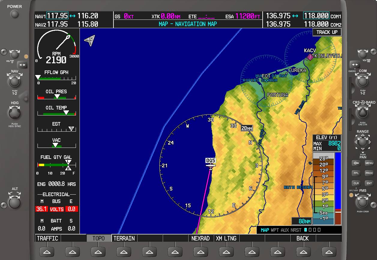
Departing runway 30 at Shelter Cove with a climbing left turn to heading 180 looks to be the way to go since there is quickly rising terrain to the north and to the east. The bad news is that the left turn takes you out over the Pacific Ocean, so it helps to have plenty of confidence in your aircraft. Here's what a G1000 would display on the ground at Shelter Cove.
If you're flying a G1000-equipped aircraft, now is the time to have the terrain feature enabled on the moving map. Whenever you see red on the terrain display, there is terrain less than 100' from your current altitude. Yellow means terra firma is between 100' and 1000' of your altitude. The absence of any colors (or black, if you have the topographic data turned off) means you're more than 1000' above terrain. If you have a hand-held GPS that displays terrain data, don't use it for primary navigation but by all means use it to enhance your situational awareness. Here is the PFD with the inset map in the lower left side of the screen set to show terrain data.
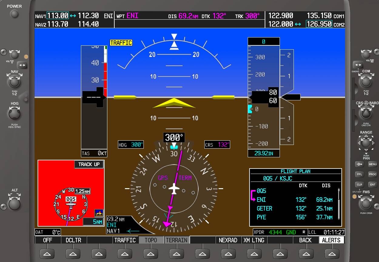
Here's what the PFD might look like climbing out from runway 30 at Shelter Cove.

As you begin the left turn toward the Mendocino VOR and begin to gain altitude, you'll begin to see more yellow than red on the terrain display.

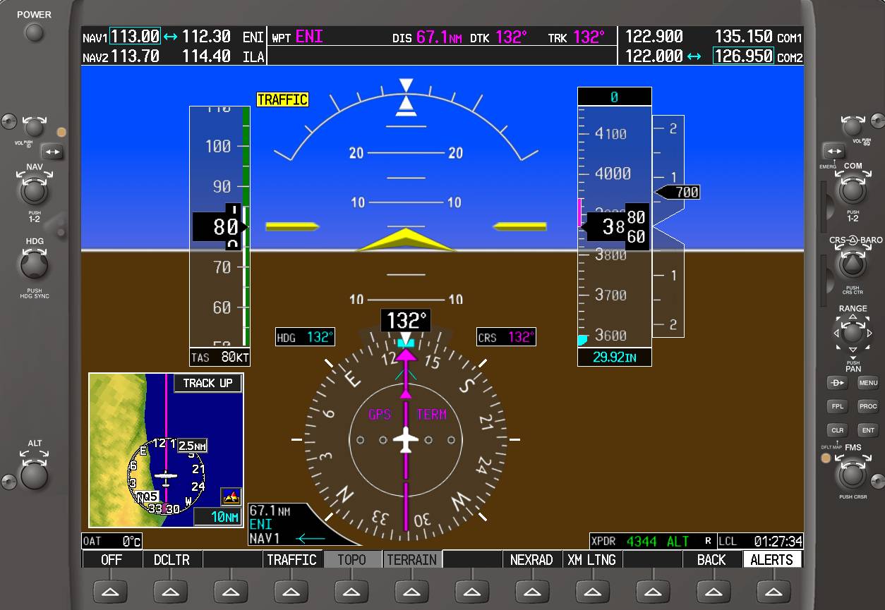
Intercepting the direct course to the VOR, almost all of the yellow and red have disappeared.
If you plan to depart VFR and pick up your clearance airborne, the weather conditions should allow you to climb to a sufficient altitude to establish radio communications with the ATC facility that provides departure control for the area. The last thing you want is to get airborne in deteriorating weather only to find you can't raise ATC on the radio or that ATC can't identify you on radar to issue your clearance. Due to terrain and the remote nature of the location, Oakland Center has limited radio and radar coverage in this area, so your best bet would be to call Flight Service on the phone to get your IFR clearance while still on the ground at Shelter Cove. Last time I was at Shelter Cove (about a year ago), my cell phone couldn't get a signal, but there is a pay phone nearby. You can see why they call this area The Lost Coast.


