


In the Garmin 430/530 and G1000 world, preparing to fly an instrument approach procedure requires careful planning if you want to avoid fancy knob twisting and button pushing during a high workload phase of flight. The easiest way to select an instrument approach with these units is to have your destination airport selected as the current waypoint (the one to which you're currently headed) or as the last waypoint in your GPS flight plan. Here's an example of using the DIRECT-TO button on the G1000 Multi-Function Display (MFD), then selecting Oakland (KOAK) from the list of nearest airports. You'd use similar steps with the 430 or 530.
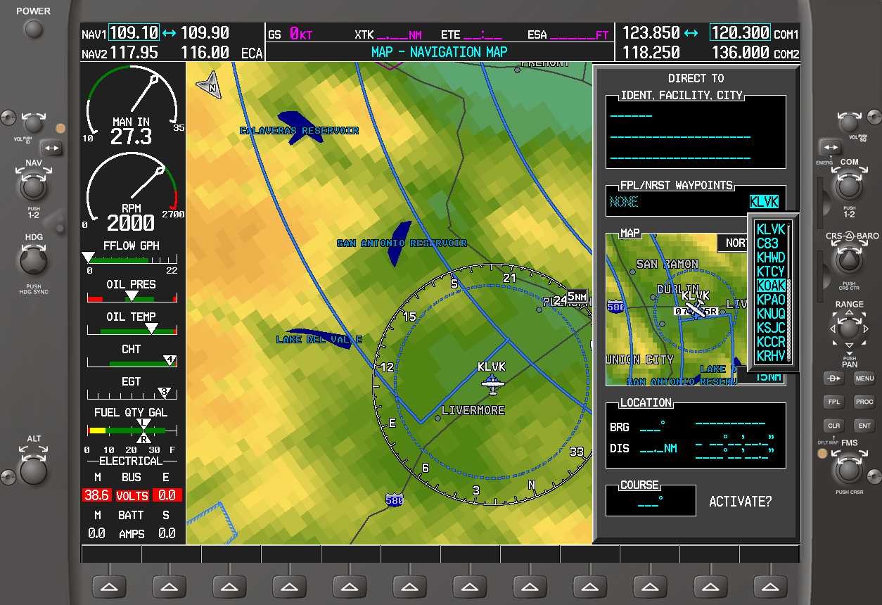
Once you have designated a destination airport, press the PROC button and a list of approaches for that airport is displayed.
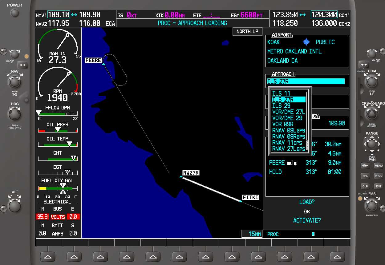
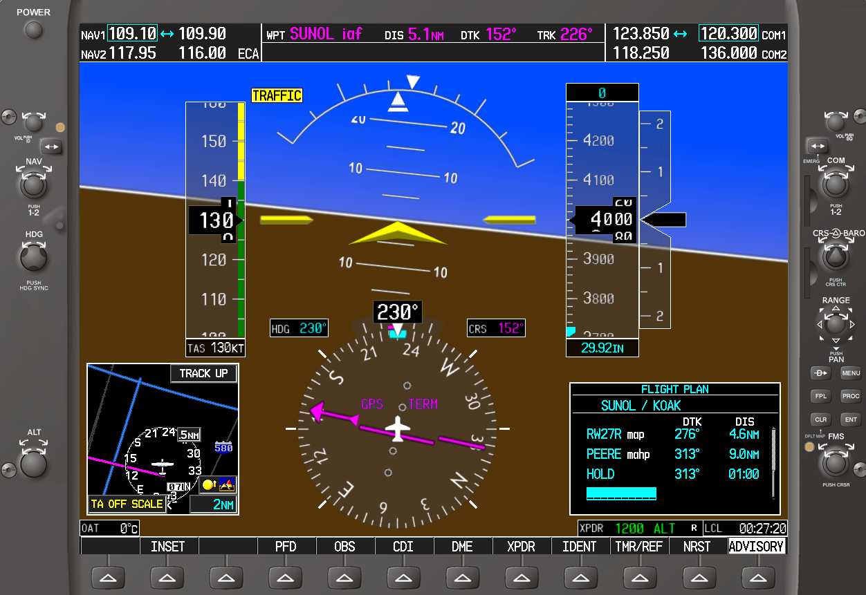
After selecting an approach, you'll see a list of initial approach fixes (IAF) from which you plan to start the approach or the option of vectors-to-final or VTF.
VTF was meant to be handy for pilots and with some approaches it is a useful option. Just as often, it's a pain in the fundament because someone at Garmin or the FAA decided that when the VTF option is selected, all approach waypoints in the initial and intermediate approach segments should disappear from the moving map! VFT leaves you with just an extended magenta course line leading to the final approach fix.

Not displaying the intermediate approach course waypoints in VFT mode is the dumbest idea since ballot initiatives. When the approach you are flying is in hilly or mountainous terrain and ATC vectors you outside one of those intermediate approach fixes, it can be difficult or impossible to know when you can safely descend if you selected VTF.
Here's an example of an approach that works well with the vectors-to-final option. The surrounding terrain is flat and the profile view shows no step-down fixes outside the final approach fix. VTF is great for approaches like this.

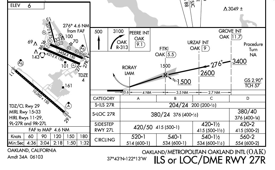
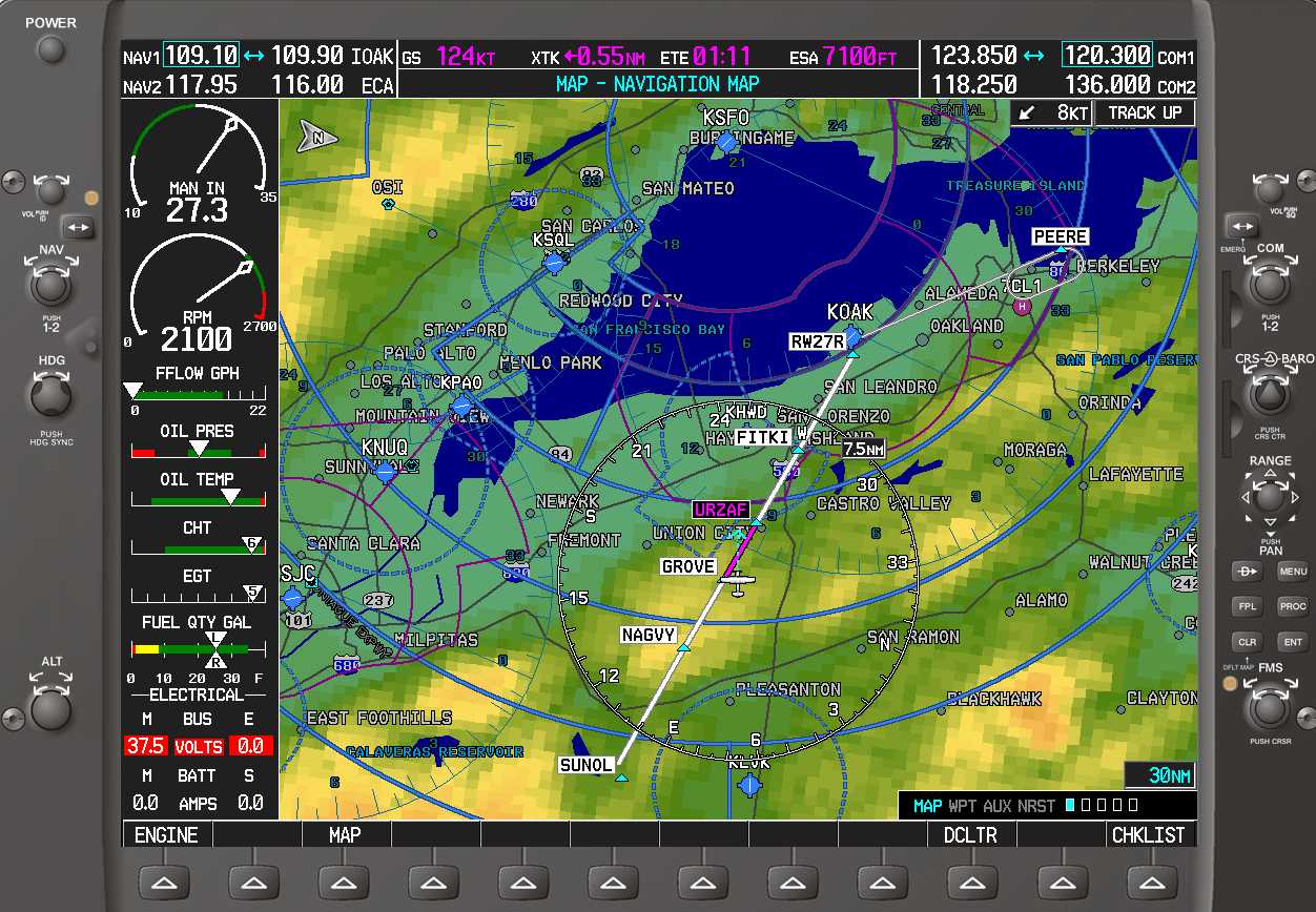
The Oakland ILS 27R approach is one of many approaches not well suited to the vectors-to-final option. There are three step-down fixes (NAGVY, GROVE, and URZAF) outside the final approach fix FITKI. More than one unfortunate pilot has descended too soon, only to crash into the hilly terrain outside FITKI.
The only alternative to VTF is to activate the approach using one of the initial approach fixes.

After you've activated the approach in this manner, the GPS thinks you want to go to the IAF (SUNOL in this case). If that's not where ATC is vectoring you, waypoint sequencing will not occur and you'll need to do some knob twisting and button pushing.

One strategy is to try to take control of the debate and tell ATC "Barnburner 123 requests direct GROVE" so that you know where you're going. If ATC is cooperative, press DIRECT, select GROVE, press ENT twice and you're golden.
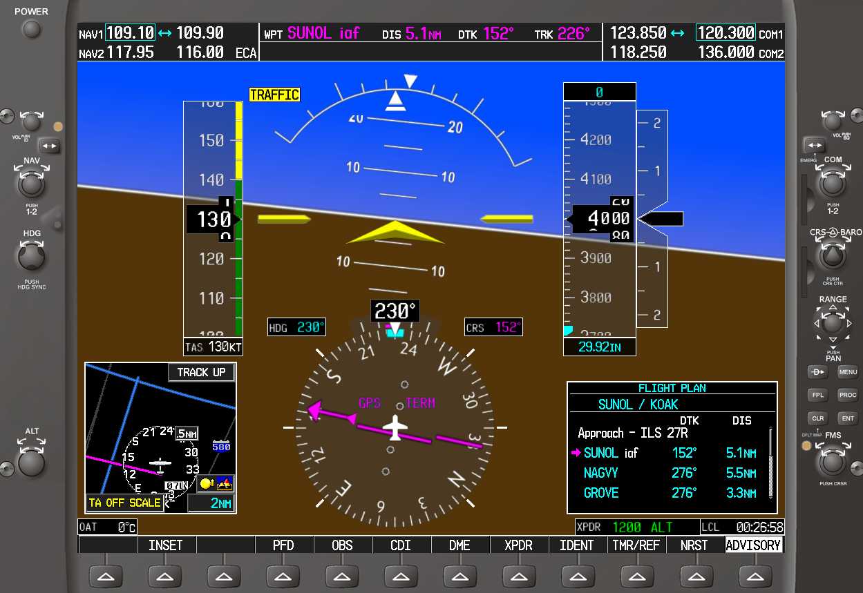
If ATC is uncooperative, another strategy is to activate the waypoint where ATC seems to be vectoring you. In this example, the assigned heading seems to be taking us to NAGVY. On the Primary Flight Display, press the FPL button and you'll see a magenta arrow or bracket showing the currently active leg or waypoint in the flight plan.
To select a different waypoint, press the small FMS knob and guess what? The cursor position jumps to the end of the flight plan. If anyone from Garmin is reading this, please change this behavior. When an approach is active, the flight plan cursor should stay put.
Use the large knob to scroll back up, select NAGVY, press Direct, then press ENT twice.
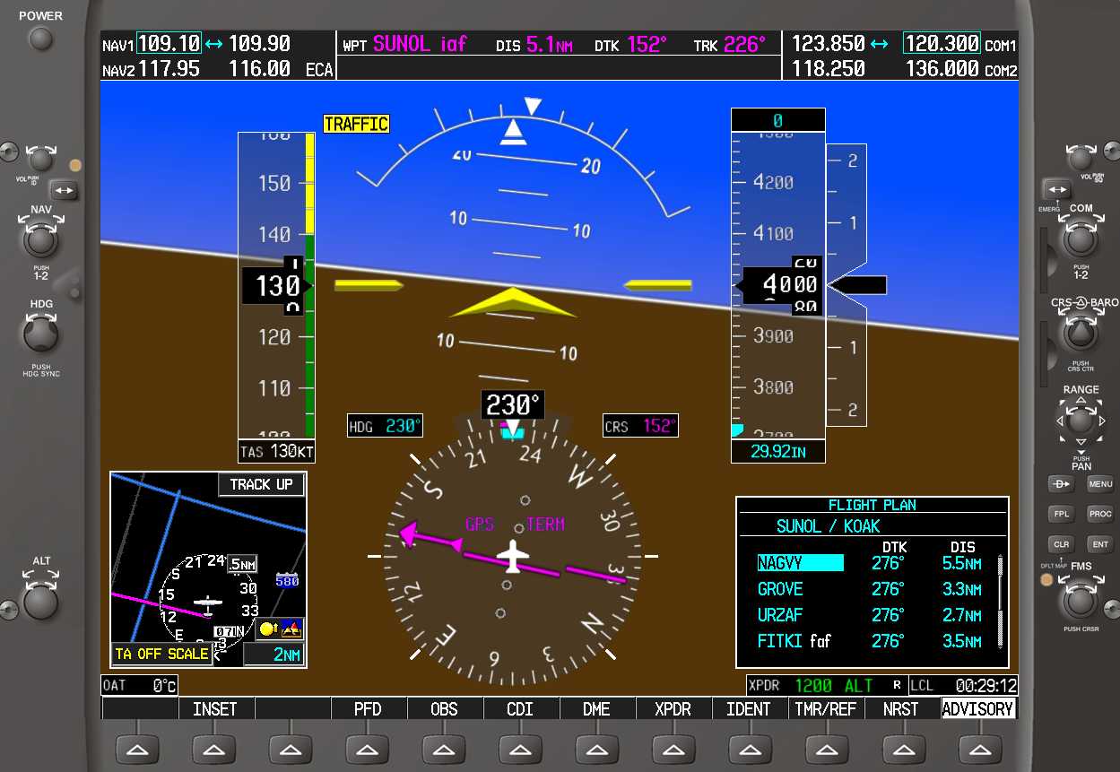
Now the GPS thinks you want to go direct to NAGVY. If you don't pass fairly close to NAGVY, automatic waypoint sequencing to the next approach waypoints will still not occur. This is not that big a deal since the approach is an ILS, right?

It's true that you'll be flying the localizer and the glideslope, so being able to see these approach waypoints on the moving map is just to let you know when you can descend to the glideslope intercept altitude. Unless you need to fly the missed approach, in which case you want the waypoint sequencing to occur as it should or the GPS can't be used to fly the missed approach.
I'm guessing that right about now you're thinking this GPS stuff is more trouble than it's worth, but take heart. I discovered a technique that consistently handles the vectors-to-final quandary with the 430/530 and G1000 with a minimum of button pushing. This technique works great when being vectored for an ILS, VOR, GPS, or any other non-precision approach. Here's the deal.
Select the approach and activate it with an initial approach fix. Press the FPL button, press the small FMS knob to enter cursor mode, and select the first waypoint after the IAF.
Now press the MENU button and select the ACTIVATE LEG option to activate the flight plan leg between the IAF and the first waypoint after the IAF.


The cool thing about this technique is that even if you get vectored well inside the leg you activated, waypoint sequencing will happen automatically.
The question on everyone's mind is Why isn't this the default VTF behavior? Maybe someone at Garmin is listening and will fix this mess in a future release. Until then, this is the best bullet-proof technique I know of for handling vectors to final with a 430, 530, or G1000.


